Excursion tip: Hike to the Hoher Kranzberg

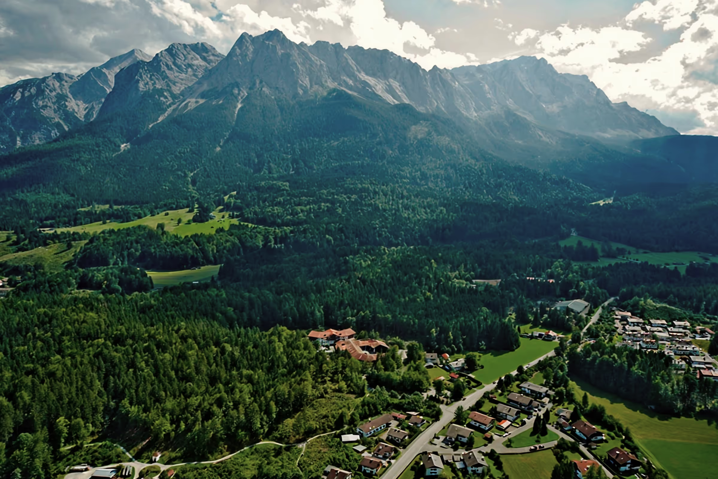
With an altitude of 1,391 m, the Hohe Kranzberg is more of a small mountain than a high one, but it offers a beautiful view of the mountain ranges around the Westliche Karwendelspitze and the Wettersteinspitze. It is bordered in the east by Mittenwald, in the west by Elmau, in the north by Schmalensee and the Buckelwiesen and in the south by Lautersee and Ferchensee. A very special highlight of this hiking tour is Germany's largest panoramic alpine barefoot trail, which is 1.6 km long.
Tour profile
Difficulty level: easy to medium
Route length: approx. 11 km (total)
ascents: 500 hm
descents: 500 hm

Most hikers climb the Hoher Kranzberg from Mittenwald, but I choose the route from Kranzbach Castle (1,040 m) for my ascent. By car, I pass the toll road from Klais to Elmau and drive up to the large parking lot in front of Kranzbach Castle. There is also a large hiking map at the car park, on which the circular trail is marked with trail numbers (809, 808, 813, 830, 840, 809).

First, it's time to walk down the road a bit until a path branches off to the right. Be careful, don't take the first right turn off here, it leads back to the parking lot (it happened to me at first, it was pretty stupid, of course) but walk down until you reach the junction where the hiking sign is also standing. In theory, you could also park here, so you save yourself the last climb back to the car afterwards. But a few more meters of hiking trail doesn't matter, at least if you're just starting the hiking tour.

Once on the correct hiking trail, it snakes more, sometimes less uphill. The trail leads through the forest; it is only further up that the first views down into the gorge and out of the mountains opposite are there.

Always stay on the main path and ignore all junctions until you reach a big fork after about 30 minutes of walking time. There is a hiking sign here again, which points to the right to the Hoher Kranzberg, on the left to the Wildensee.

Following the right path, it continues straight on from time to time, then uphill again. The path gets narrower and you reach another junction about 30 minutes later. Here it's time to turn left. You can't see anything about the summit yet; it remains hidden. Don't be surprised if a sign for 10 minutes to the summit is displayed twice, even if you've already walked 10 minutes before, you don't have to understand that, because the signs here are in the region (you can count yourself lucky if you don't stand on the sign for another 30 minutes). I pass a few alpine meadows on the left, but otherwise I only have trees in front of my eyes. This changes after another left turn. Most hikers who climb the summit from Mittenwald also appear here. It's been pretty lonely on my route so far.

Now I get on the wider hiking trail and finally I have a view of the mountain ranges as well as the Kranzberghaus located some distance away and the summit cross behind it.
After traveling almost alone before, it's already busy here. The sunny weather has attracted many hikers to the mountain. The summit seems to have already been taken up by hikers, so I use one of the rest benches before the summit for a short breather. I sit more quietly here than on the summit with 40 other hikers. Everyone the way they want. The Kranzberghaus is closed, but I've taken precautions and packed a bottle of Radler which, still well chilled, I now open and enjoy with a roll. My gaze wanders out to the surrounding mountains. Butterflies fly around me, someone probably mistakes me for a flower and doesn't even want to get off me anymore. Perhaps my blue shirt is similar to the blue gentian that is still blooming along the way.

The thirst and initial hunger after the climb have been quenched and so it is now time to go up to the summit. A few more meters and then I too am standing at the summit cross. Most hikers enjoy their break here, either on the grass or on one of the relaxation benches that were kindly set up here. There is a 360° panoramic view from Hoher Kranzberg. I walk around the summit cross once and can already see the Wildensee, which will be my next destination on the descent round.

After thoroughly enjoying the panorama, I start the descent. Briefly down from the summit, then turn off before the Kranzberghaus on the path that leads to St. Anton. The road is now paved for cars bringing provisions to the Kranzberghaus. Sometimes it goes very steeply downhill, but to the right of the paved path there are small alternative routes that are a bit flatter.

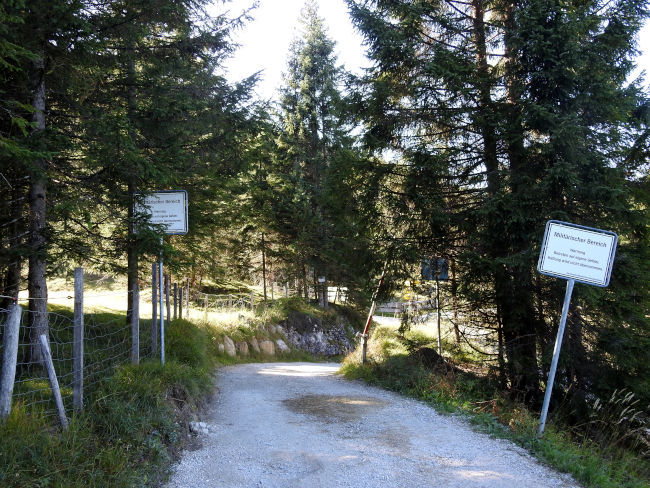
At the avalanche warning service measurement field, you then come across the barefoot path. If you like, take off your shoes and follow the signposted path. Some information boards explain the special sections of the trail. I need the soles of my feet because I am very sensitive underfoot and so I follow the main path down to Berggasthof St. Anton. It is open today and the terrace is well visited in this weather.

I also leave the mountain inn to the left and continue towards the gondola station. The gondola station with twin seats offers a convenient alternative to getting to Berggasthof St. Anton without straining your muscles. For me, the sporty version is more enjoyable; I can also eat thick ice cream without a guilty conscience, which I can already see in my mind at the last mountain inn in front of me.

In front of the cable car, my path also branches off and leads along the ski slope down to Lake Wildensee. The Wildensee is beautifully nestled in a beautiful landscape and is also surprisingly empty. I won't meet any crowds here. And the terrace of the Berggasthof am Wildensee is also vacant except for 2 tables, so I now sit down here and order my long-awaited ice cream sundae. With the sunny temperatures and the climb behind me, it's the best fun in addition to the great views.

If you don't want to stop off, the park bench by the lake is ideal. A stop at the lake is a must. If it was warmer, I would certainly have stepped in with my feet. So only a few ducks swim in the lake.

For me, I now continue along the road that leads into the military area. I'll follow them to a big turning circle. Continue straight ahead there. The path would lead down to Klais to the right. Continuing straight ahead, I come to a first junction that leads left to Hoher Kranzberg. Where the path leads straight ahead is of course not marked on the sign. In any case, continue straight ahead here, after all, you don't necessarily want to go up to the summit again.
After about 30-40 minutes from Gasthof Wildensee, the turnoff finally appears again, where I first turned right to reach the summit. I have now finished the circular route here and it is now only downhill on a known route and back to the car at the end of the road.
How to get there by public transport:
Eibsee bus to Garmisch-Partenkirchen station, then by regional train to Klais station, Krün. Or from Garmisch-Partenkirchen station, take bus 9608 towards Kochel am See to Klais station, Krün. From the train station in Klais, you have to walk about 2-3 km to the starting point of the hiking route, but you can take the earlier descent to Klais on the way back.
Alternatively, there is also a bus to Kranzbach Castle. Saturdays: Regional train at 10:02 Garmisch-Partenkirchen to Klais, then by bus 4608 towards Mittenwald to Kranzbach Castle. Arrival 10:25. Return at 15:24 by bus 4608 to Mittenwald and from there at 16:36 by regional train back to Garmisch-Partenkirchen. However, travel times are limited. Exact travel times over www.bahn.de
Heartily Wellcome
at Lake Badersee