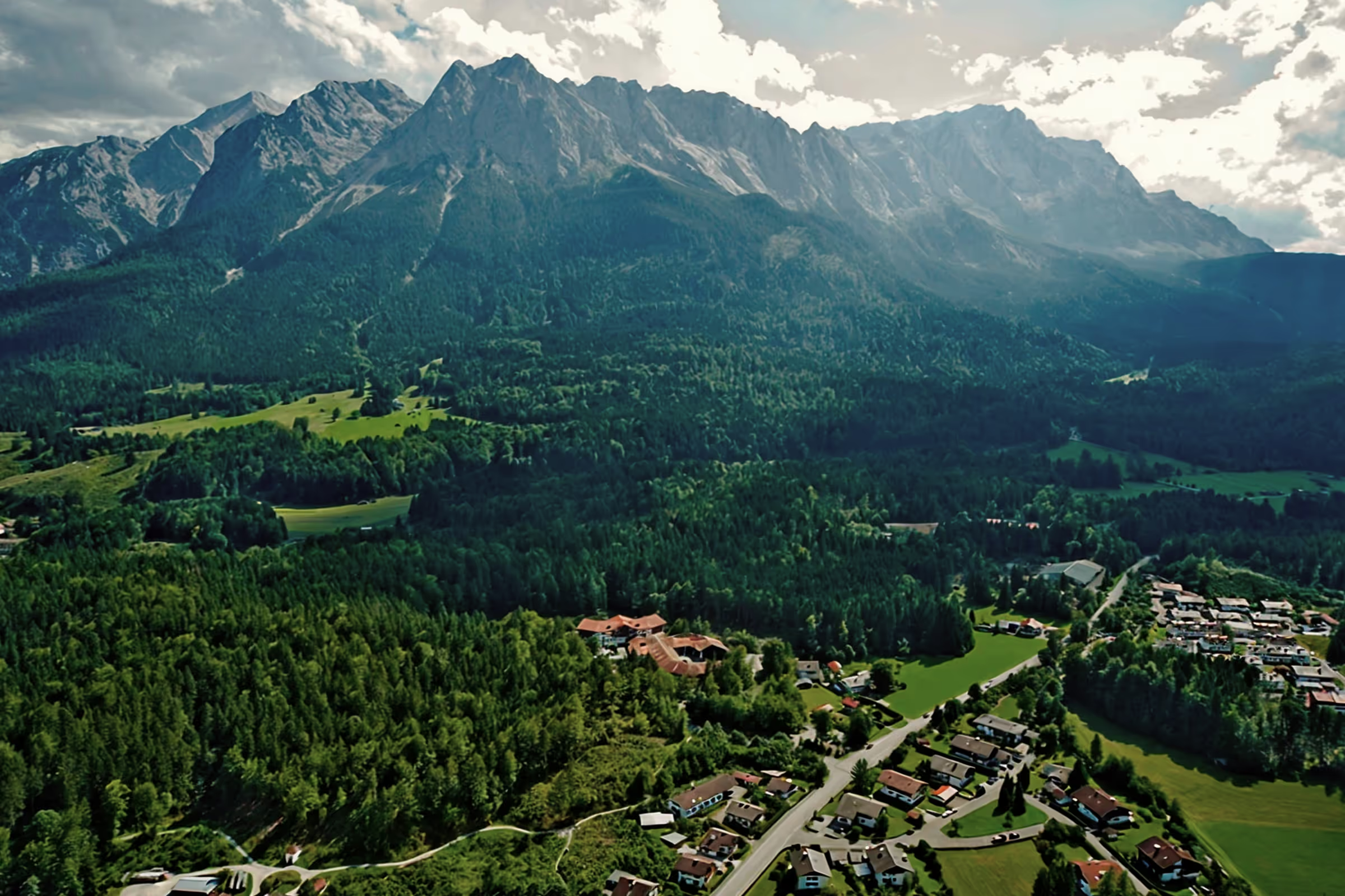
A perfect day in Grainau: hiking to Wamberg

Winter is coming to an end and snow has already been removed from the higher mountains. Time to get your hiking boots out of the closet for a first summit tour. The hiking tour to Wamberg leads through Germany's highest church village and thus combines culture with nature.
Tour profile
Difficulty level: medium
Route length: approx. 14 km
ascents: 650 meters
descents: 650 meters
10:00 a.m.: Take the car to the starting point of the hiking tour, which is located in Kaltenbrunn. At the entrance to the village, you drive to the wine shop. There, a little street turns left where you can park the car.

10:40 a.m.: The hiking tour can start. Water and food are stored in the backpack for a break with a view of the summit. The trail goes under the railway line and on a gravel path to a junction. From there, you walk past the power plants next to the Kankerbach until you reach a junction with the asphalt road, which comes over from the right.
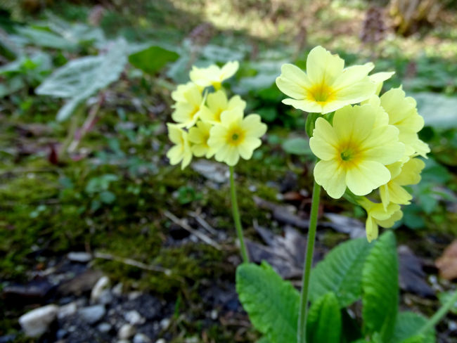
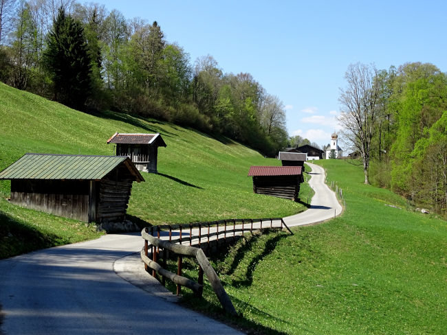
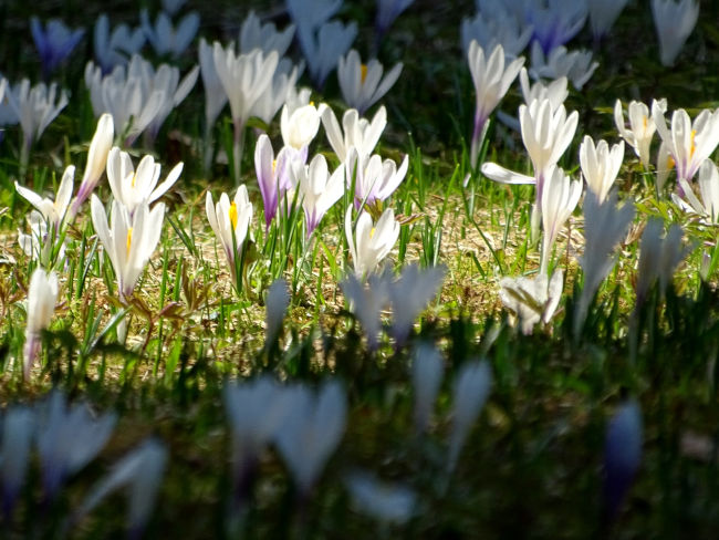
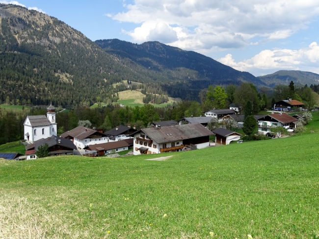
11:45 a.m.: You walk along the asphalt road, always uphill, past woods and meadows to the idyllic village of Wamberg. Primroses, wood anemones and crocuses bloom along the way, a true explosion of color after the snowy winter. The village of Wamberg is just over 45 minutes to 1 hour away from the starting point of the hike. Even from afar, you can see the historic church from 1721. When the church door is open, it's worth taking a look inside. It has an artistically very valuable high altar, a work by sculptor Andreas Onich. First of all, it takes me to Berggasthof Wamberg, which is already open at 11:00 a.m. I sit down on the sunny terrace.
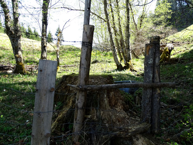
12:15 p.m.: After a refreshing cyclist, the tour can continue. The trail continues behind the mountain inn on meadow and forest trails. Behind a depression, I enter the forest, where the tug trail branches off behind a stream. There it continues to the right and climbs very steeply through the forest. It really gets the circulation going and the thigh muscles have fun. A short time later I cross a clearing and it goes back into the forest. The old lane ends at a barn. From there, you walk up through a forest belt and to a pasture fence. Attention! There are no hiking signs along the trail, but the trail is still easy to identify.
12:30 p.m.: After the crossing, you cross a sheep pasture, climb over an overpass again and keep a little right behind it to follow an suggestive route across a wide meadow slope to a haybarn on the edge of the forest. Along the way, there are the first beautiful views of Garmisch-Partenkirchen with its still snow-covered peaks and the meadows are partly covered by crocuses that shine in the sunlight. Spring is really a treat for the eye.
12:45 p.m.: The trail leads back into the forest. Here, the lane is clearly visible again. It crosses a stream, then the trail is lost more and more and can no longer be recognized. But if you keep going, you come to a pasture fence and finally reach a gravel road behind it. This section is a bit tricky, but once you reach the fence and the gravel road, you follow them further uphill.

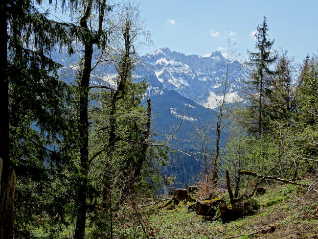
1:00 p.m.: Continue along the gravel road until you reach an intersection at just under 1,200 m. Here, the road widens and makes a tight right turn as it progresses. A little further on, you reach an official hiking sign that points the way to Wamberg. The route continues in the lane and leads, sometimes in steep ups and downs, to the Wamberg summit. The higher you get, the more beautiful the mountains with the snow-covered peaks are. With these views, you know once again why you are doing the hardships of climbing. At the Wamberg summit, which can be reached after just under 2 hours from Wamberg, there is also a rest area where I now settle down again. Now it is time for refreshments while I enjoy the view and the sun.
3:00 p.m.: Even though I could sit here forever, at some point I'll have to move on again. After a long rest, it's time to head back. The trail runs up and down along the summit ridge. Here you'll pass some shelters and seating areas with panoramic views of the majestic mountains. Here you simply have to pause again to take in the panorama. Yes Mei is that nice! I just can't get enough of it. I then follow the path to a fork in the road at the edge of the forest. Here you keep to the right and continue to a crossroads. Here, too, I turn right again and I climb a steep path down to Wamberg, which awaits you again with its picturesque church.
3:45 p.m.: From Wamberg, follow the same path back to the starting point of the hike, now just running downhill and along the river again to Kaltenbrunn.
Tips & info:
- By public transport, you can reach Kaltenbrunn from Garmisch-Partenkirchen train station by bus no. 9608. Please check the timetable.
- The trail is not marked from Gasthaus Wamberg up to the official hiking sign on the gravel road and can only be identified by trails. If this is too tricky for you, you can also reach the Wamberg summit via other official hiking trails.
- Berggasthof Wamberg is open Tuesday - Sunday 10:00 - 18:00
Heartily Wellcome
at Lake Badersee