Top hiking trail stage 1: From Murnau to Eschenlohe

For me, the top hiking trail will be the 10th long-distance hiking trail, which will once again bring me closer to another piece of German natural and cultural landscape. However, it will also be the long-distance hiking trail with the highest altitude difference and I actually have great respect for that. But the first stages will start easily for now and that's how you can get started.
Tour profile
Difficulty level: easy
Route length: approx. 26 km
ascents: 330 meters
descents: 300 meters
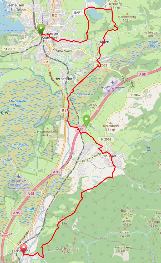
Map © www.ich-geh-wandern.de
Top hiking trail — experience the natural landscape of the Zugspitze region over 200 km
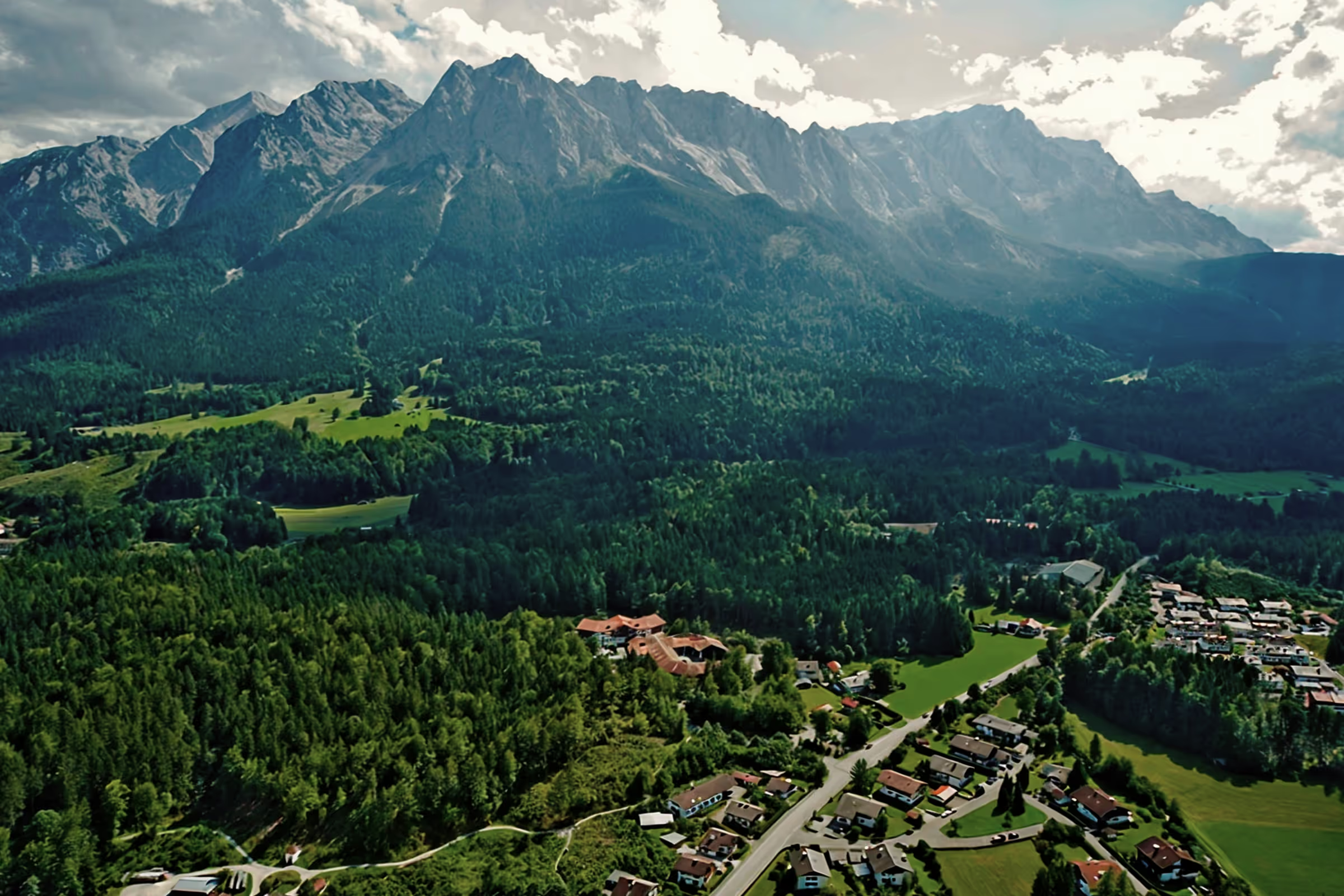
Not too long ago, the Spitzenwanderweg was ceremonially opened. The long-distance hiking trail covers 200 km and 12 stages through the picturesquely diverse landscape of the Zugspitze region. More than 6,800 meters of altitude difference are also covered, so the top hiking trail is quite a sporting endeavor. But it's worth it. Because the trail leads through a diverse landscape and also passes through numerous cultural monuments. The start and end point is the picturesque town of Murnau. Two overnight stays in huts are included on the long-distance hiking trail, once in the Soiern House and once in the Schachenhaus. On the 200 km, hikers pass fantastic views, flower-rich mountain and moor meadows, deep blue mountain lakes, bubbling springs and rivers, the spectacular Partnach and Höllental gorge, foothills of the Alps with far-reaching views, as well as cultural monuments such as the royal castles of Schachen and Linderhof Castle, as well as typical Bavarian villages such as Murnau, Krün, Mittenwald, Grainau or Oberammergau. There is therefore much to experience and discover on the 200 km long trail.
And we too are keen on the long-distance hiking trail and are treading this stage by stage, because the trail will also be a special experience for us locals. I will walk the path partly alone, but also with my colleague. Join us on the hiking trail.
The top hiking trail: All stages at a glance
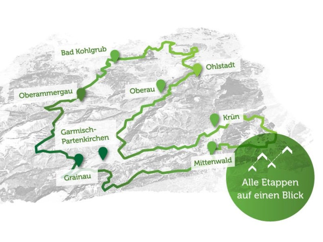
Picture © spitzenwanderweg.de
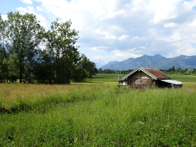
From Murnau to Eschenlohe
“You were only really where you were on foot. ”
Johann Wolfgang von Goethe
I start the first stage on a Saturday morning at just before 07:00, as rain showers are already announced for the early afternoon and so I want to take advantage of the sunny morning to complete the stage. It should also be very hot, 25-28 degrees Celsius is the order of the day, so my backpack is packed with 1.8 l of drinks, food for snacks on the route and, of course, an umbrella should it start to rain earlier. I park the car at the train station in Murnau, as I will be back there by train at the end of the stage. The parking fee is just 1€ for the entire day. I put on my backpack and the hike can begin.

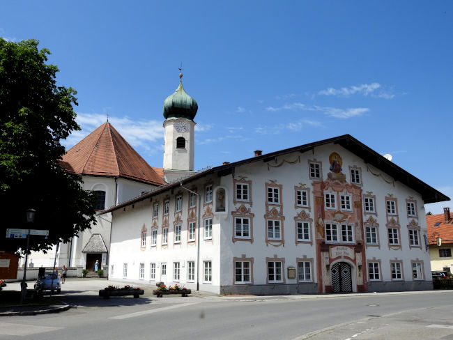
From the train station, head to the town center. On the beautiful Murnau shopping street, the Obermarkt and Untermarkt, which is still almost deserted at this morning hour, I come across my hiking sign, which will accompany and guide me on the tour. I follow the sign past the castle museum and St. Nicholas Church. At the Jesus Cross, I briefly ask for strength and endurance to overcome the approximately 23 km loose foot. Then it's off to a detour across Froschhauser See.
ATTENTION: There is no sign for the Spitzenwanderweg here. When you reach the end of the street “Am Eichholz”, walk straight ahead along the trail and then turn into the footpath (corner of Hagener Leite/Leitenweg). Here is a hiking sign for various routes around Murnau and the trail markings for the Ammergau Alpine Meditation Trail (yellow heart on a blue background). I pass the last houses in Murnau until I reach another fork in the road at a bank. Here I first have to see how the path continues. Not straight ahead, but diagonally left, I have to go into the forest, following the sign Froschhauser See/Riegsee.

I dive more and more into nature, first through a small stretch of forest, then the forest opens up and offers a distant view of Lake Froschhausen. I've left the sounds of the city behind me. Birdsong, chirping and the cows' bells now determine the sound of nature. I continue along the path into the village and then turn right, cross the village with its beautiful St. Leonard Church, which has been a pilgrimage church since ancient times. I continue to follow the road and leave the small town again.
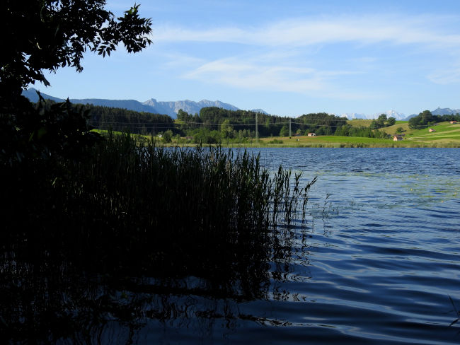
Froschhauser See is now on the right, Riegsee on the left. Both lakes are swimming lakes. Unfortunately, the trail does not lead directly along the shores of Lake Froschhausen, but anyone who wants to can get to the lake, take a short swim in the lake, or at least dip their feet in. The bathing areas are marked, the rest of the shore area is a protected area for birds. I continue straight ahead, then the trail branches off the main road slightly to the right and after the gravel pit I turn right onto the forest path. Passing meadows where crickets are chirping, I now follow the path towards Hagen.
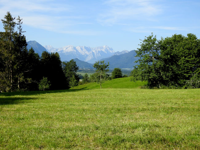
After a small stretch of forest, the trail opens again and offers a great first panorama of the alpine world with the Zugspitze massif. Murnauer Moos is spreading in front of it. At the panorama, I treat myself to a first snack. Almost two hours have passed since I left the train station. After my first hunger and thirst have been satisfied and I have thoroughly enjoyed the view, I'm ready to go again. Coming from the forest at the fork in the road, I continue to the right. I follow the mountain trail, which after a few 100 meters leads slightly downhill to the village of Hagen. There I also come across the hiking sign of the Spitzenwanderweg again.
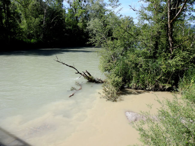
The long-distance hiking trail leaves the town of Hagen on steep roads and descends to the main road. It is necessary to cross this. You should make a short stop at both bridges, because first you cross the Ramsach River, which flows slightly brownish, muddy, and at the second bridge the Loisach, whose water shimmers bluish. Water flows from the Ramsach river into the Loisach, which is easily recognizable by the difference in color. Both rivers are quite full after the rains, and the water of the Loisach is usually even bluer.
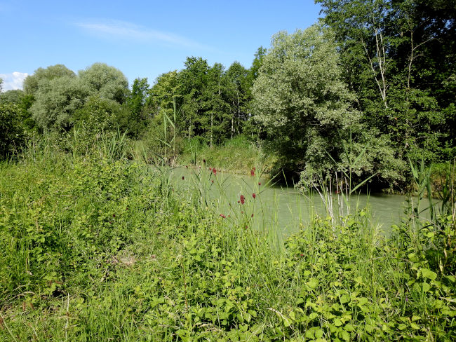
After the second bridge, the trail branches off to the right again and the next kilometers run parallel to Loisach. It is a nice trail, slightly sandy and therefore feels soft under your shoes. A nice change from the previous rather tough roads. However, the rain last night created a lot of puddles and so the trail becomes a small obstacle course. In order not to get my hiking boots completely dirty and leave my pants somewhat dry, I go past the puddles on the right or left, depending on where the path seems harder. It also includes a few jumps over puddles.
Some places open again and again, from which you can reach the water. In theory, you could dip your feet in cool water, but currently the river flow is so strong that you can quickly get carried away. I walk through a green tunnel made of trees, bushes and reeds. From time to time, the view opens up and I see the alpine panorama in front of me.
What I didn't expect here, however, is the huge number of mosquitoes that are currently orbiting me. Of course, optimal conditions prevail here: humidity and humidity. Even though it's just before 10 o'clock, it's already pretty warm. As soon as I stop to take a photo, 20-30 mosquitoes settle on my arms and legs. I thought of putting on sunscreen, but mosquito spray? I would never have thought of that. It's just good that I'm wearing long pants, otherwise my calves would definitely be punctured in no time at all.
I can still remember hiking in Reunion too well with shorts. After that, my calves looked like I had chickenpox. I counted 47 mosquito bites back then. I don't want that to happen again. And if there is no mosquito repellent, then only one thing helps: running as long as it takes. Accordingly, I am more likely to go Nordic walking until I have left this part of the hiking trail behind me, the trail opens again and open meadows dominate the landscape. It is then too hot for the mosquitoes here and I can breathe again.
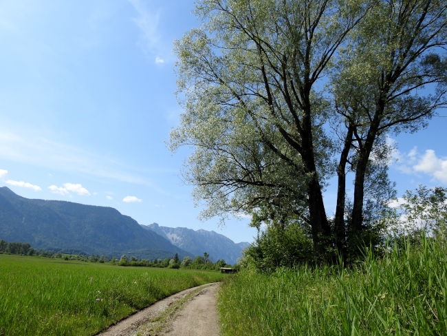
Fortunately, I have my bite-away stick in my camera bag and so I start working on the first visible mosquito bites on my arms so that they don't start to itch and annoy me the rest of the way. I'm curious to see how the investigation will turn out in the evening. Without annoying mosquitoes, I can fully enjoy the next part of the journey again. Orchids and the spotted Gold Felberich bloom in the meadows. Now Ohlstadt is not far away anymore. I hit the bike path that leads me into the village. Before I reach the village, however, a bench is ideal for a next break with a view.
Now I was actually planning to stretch my legs on the bench, breathe in the fresh air and generate myself for about half an hour when it suddenly starts to wind coolly and the initial warmth is no longer noticeable. I look up at the sky and I just see cloudy, grey clouds rising. It's too uncomfortable for me on the bench now, so put my backpack back on and into the town of Ohlstadt.
There is still a bench here in the slipstream, on which I now want to catch up on the break and watch the weather to see if it should change after all. I would still be close to a train station if it suddenly started to rain. The weather forecast still says no, but you never know in the mountains.

The grey rain clouds disappear as quickly as they appear and the sun regains the upper hand. In no time at all, the temperatures have risen again and I can feel the onset of midday heat on my skin. Let's hope that the last stretch of the hiking trail between Ohlstadt and Eschenlohe will go through the forest so that there is cooling shade.
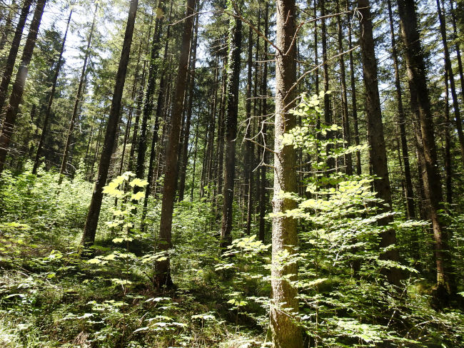
First, however, we head out of Ohlstadt under the blazing sun. This once again offers beautiful views. Then it finally goes into the forest and the temperatures immediately drop by a few degrees, it is now much more pleasant to walk. The chirping of birds provides musical entertainment along the way. The sunlight shines through the forest and makes the leaves of the trees light up.
I'm really surprised how lonely I've been on this hiking trail so far. Shortly before Ohlstadt, I've only met many cyclists who seem to be using the beautiful cycle network between Murnau and Garmisch-Partenkirchen, but so far I've hardly met any hikers. It is only here in the forest that I meet the first hikers, but they are really few. But you can enjoy the landscape all the more in peace and quiet.
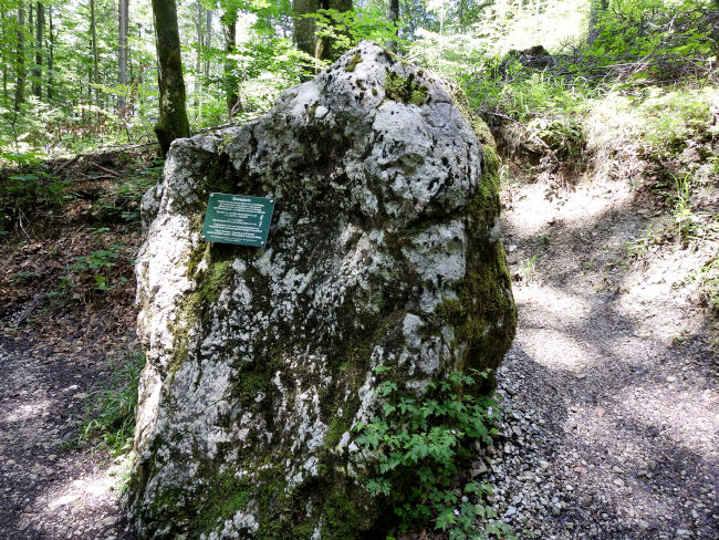
A big rock catches my attention. As the information sign on the stone explains, this is a landmark between the municipalities of Eschenlohe and Ohlstadt. Until secularization in 1803, he separated Hofmark Ohlstadt, which belonged to Schlehdorf Abbey, from Eschenlohe and from the Ettalian care court of Murnau. The symbols of the two areas from 1670 can still be seen on the border stone. Of course, I also have to look at them before I continue.
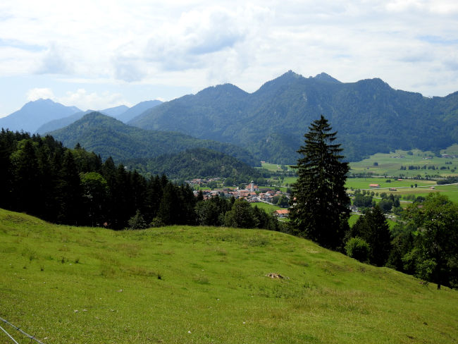
The forest will soon open up again and I can already see my final destination Eschenlohe from afar. With this great view, there is one last lunch break before the final spurt starts. Now I'm getting my still ice-cold non-alcoholic cyclist out of my backpack and the salad I took with me for lunch and enjoy the great panorama that unfolds in front of me.
After the break, I take a look at the train app. In about 40 minutes, the next train goes back to Murnau from Eschenlohe. Then I'd have to wait another hour. So it's time to hike non-stop to Eschenlohe, because it would be nice to catch this train. I leave the turnoff and the trip to the Heldenkreuz alone, I can still climb the small summit another time. After 21 km, I'm more looking forward to my hammock at home and the view of the Zugspitze.
I reach Eschenlohe, cross the bridge and arrive at the train station on time to get another ticket before the train rolls in. I've done it. The first long stage was completed and went faster than expected. It was also very exciting and makes you want more.
Tips stage 1:
- Route length: 21 km, performance kilometers: 25 km, access: Murnau & Eschenlohe railway station approx. 1 km
- Walking time without a break: approx. 5 hours
- Moderately difficult hike, mostly hilly terrain, mostly on wooded and paved roads.
- Unfortunately, the tourist office only provides an overview map of the Spitzenwanderweg. There is also no digital trail map on the official Spitzenwanderweg website. The best navigation is therefore here.
- If you don't want to start so early in the morning, you can also easily arrive and depart by train. Trains travel every hour from Garmisch-Partenkirchen station towards Munich via Eschenlohe, Ohlstadt and Murnau. From Hotel am Badersee, take the Eibsee bus to the train station and then get on the regional train.
- In Murnau, you can buy a snack in the morning at the supermarket or from the bakery in the pedestrian zone, which you can then enjoy along the way.
- There are restaurants in Ohlstadt as well as in Eschenlohe.
- If the stage is too long for you, you can also divide it and stop in Ohlstadt and start again from there all the way to Eschenlohe.
- You can run the stage all year round, even in winter it would be possible. In summer, be sure to use sunscreen and possibly also wear a hat, as large areas lead across open terrain. Don't forget mosquito repellent.
Heartily Wellcome
at Lake Badersee