Top hiking trail stage 10: From Linderhof Castle to Unterammergau

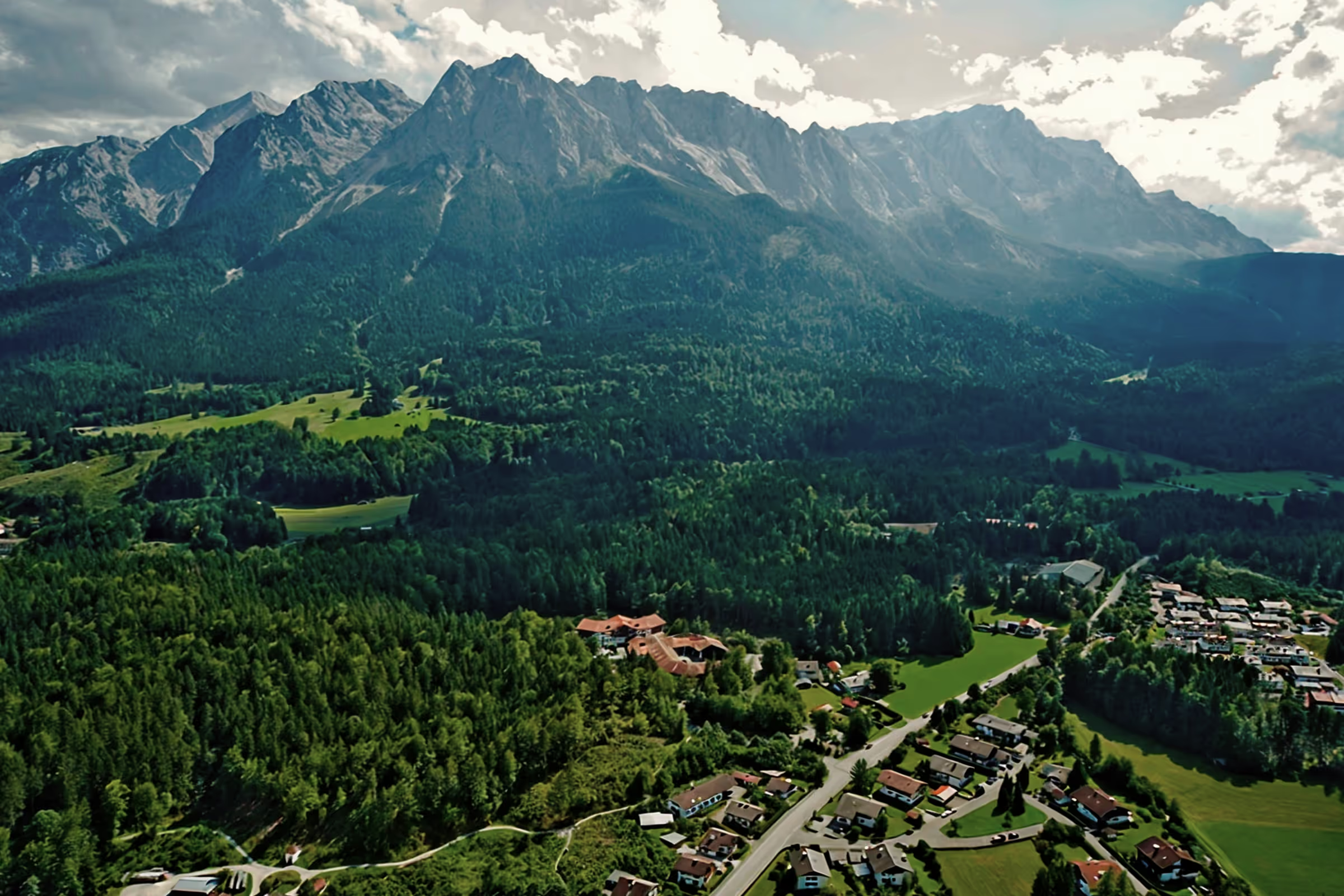
The tenth stage of the top hiking trail takes long-distance hikers across the Ammergau Alps from Linderhof Castle to Unterammergau. You cross the 1,566 m high Pürschling-Berg and hike on the European long-distance hiking trail E4, which is the longest European hiking trail with a length of over 10,000 km. In contrast to stage 9, this stage is again a mountain stage that leads on narrow, rocky and root-rich trails through a mountain forest up to the Pürschling, and on the other side either on the wider forest road or a forest trail down to the village of Unterammergau.
Tour profile
Difficulty level: medium
Route length: approx. 17 km (total)
ascents: 600 hm
descents: 650 hm
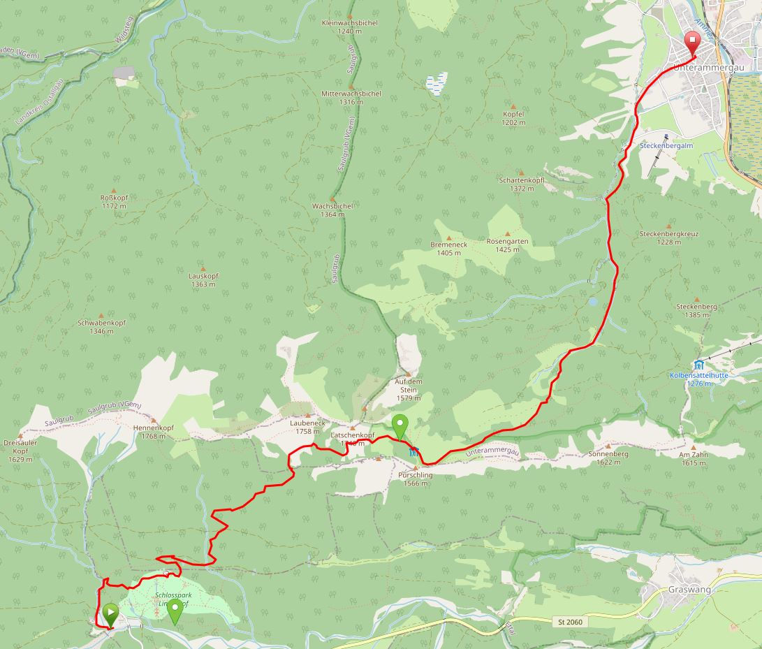
Map © www.ich-geh-wandern.de
Top hiking trail — experience the natural landscape of the Zugspitze region over 200 km
Not too long ago, the Spitzenwanderweg was ceremonially opened. The long-distance hiking trail covers 200 km and 12 stages through the picturesquely diverse landscape of the Zugspitze region. More than 6,800 meters of altitude difference are also covered, so the top hiking trail is quite a sporting endeavor. But it's worth it. Because the trail leads through a diverse landscape and also passes through numerous cultural monuments. The start and end point is the picturesque town of Murnau. Two overnight stays in huts are included on the long-distance hiking trail, once in the Soiern House and once in the Schachenhaus. On the 200 km, hikers pass fantastic views, flower-rich mountain and moor meadows, deep blue mountain lakes, bubbling springs and rivers, the spectacular Partnach and Höllental gorge, foothills of the Alps with far-reaching views, as well as cultural monuments such as the royal castles of Schachen and Linderhof Castle, as well as typical Bavarian villages such as Murnau, Krün, Mittenwald, Grainau or Oberammergau. There is therefore much to experience and discover on the 200 km long trail.
And we too are keen on the long-distance hiking trail and are treading this stage by stage, because the trail will also be a special experience for us locals. I will walk the path partly alone, but also with my colleague. Join us on the hiking trail.
The top hiking trail: All stages at a glance
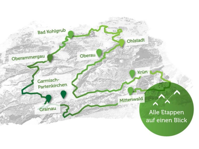
Picture © spitzenwanderweg.de
To stage 9: From Grainau to Linderhof Castle
Stage 10: From Linderhof Castle to Unterammergau
“Climb the mountains and feel the good energy. Peace in nature will flow into you like sunshine feeding the trees. The wind will refresh you, the storm will fill you with strength and all your worries will fall away from you, like autumn leaves. ”
John Muir, Scottish-American polymath, 1838 — 1914
The weather promises a sunny autumn day for today, but with temperatures of 11-13 degrees. Accordingly, there is nothing standing in the way of tackling the 10th stage of the peak hiking trail. It rained heavily the day before, so we prepare ourselves for hiking trails that are still moist, put on sturdy hiking boots and pack an additional warm jacket in case it gets cool at the summit.
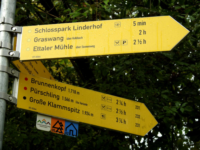
We drive to Linderhof Castle by car and park in the hiking car park on the left hand side of the castle. The hiking trail starts from here. Another quick look at the hiking sign, which states that it will take you 2:30 hours to get to Pürschling.
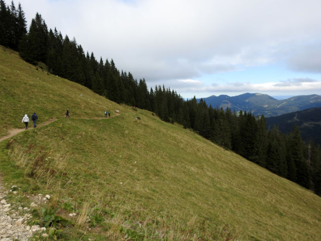
With many other hikers who set out on a hiking tour from here on this beautiful autumn day, we start on the same route. However, just a few hundred meters away, our top hiking trail branches off and leads from a wide forest trail onto a small nature trail. With that, we say goodbye to the other hikers, who continue straight ahead along the path to Brunnenkopf. For now, we're alone and enjoying the silence of the forest.
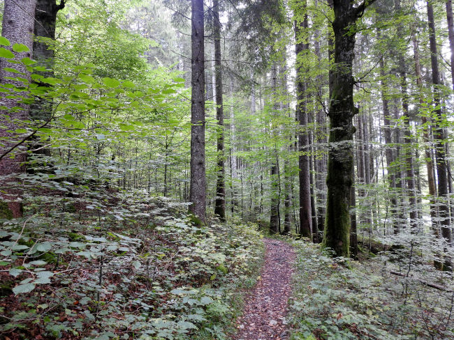
After a short climb, the trail is initially flat and we are now above Linderhof Castle and the royal park landscape. Unfortunately, there is no view of the castle from above. The trail then climbs up again and we reach a larger forest road, which we now follow. After a short time, a trail branches off to the left again and leads us into the mountain forest until we once again reach a higher forest road and now follow it again for a while until another hiking sign from the forest road points to a narrow path, which now leads steeply into the forest via roots and stones.
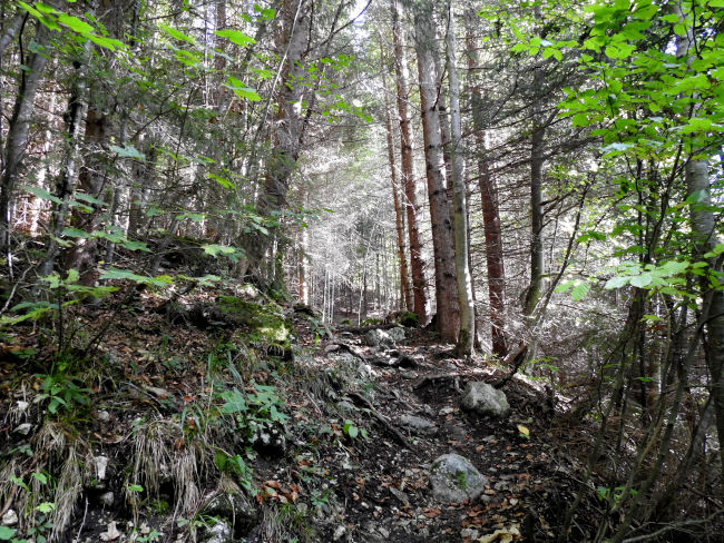
So far, the hiking trail has been fairly easy to walk, with some steeper sections followed by flat passages again, particularly along the forest road. According to the hiking sign, we have already completed 1 hour of the entire route, although the previous stretch seemed shorter and we were actually traveling faster. The time gives me a feeling of happiness at first, but I'm afraid that the difficult part is yet to come. From now on, it's always uphill, the trail is a beautiful nature trail, but partly crossed by the roots of trees and larger stones. After the first bends, we find a sunny spot with larger rocks in the forest and first take a break to have a drink. The huge rocks serve as seats for this purpose.
Although the temperature is just 11 degrees today, the direct sunlight is warm and we are literally enjoying our beautiful place in the sun. Until now, we've been traveling alone, but now we meet the first hikers who pass us by. We too pack up our things again and walk across the dried-out riverbed. But where is our path actually now? Somehow we lost sight of him after crossing the stones and are hiking uphill through the green without seeing our actual trail. The two hikers who have walked in front of us have probably had the same experience, but are now calling out to us from higher up that the trail is here again. So now it's cross-country uphill until we too have reached the path where our predecessors also came from.
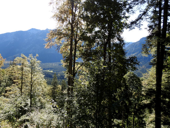
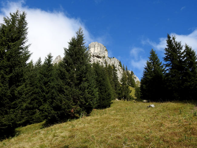
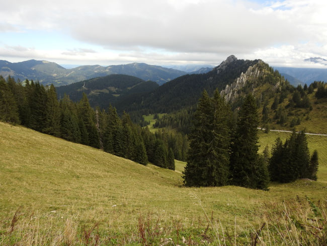
It's always uphill. After the first rest, my muscles had recovered a bit and things are going well for now. But I'm slowly noticing the muscle strain again and I wonder how far it will be to the summit. On the first stretch of the hiking trail, the hiking signs were still highly motivating for me, as the time to reach the summit had visibly reduced quickly. But now I'm missing those signs. After all, the beautiful mountain forest now also offers the first views of the mountains surrounding us and we have already visibly gained altitude. However, our summit destination remains hidden.
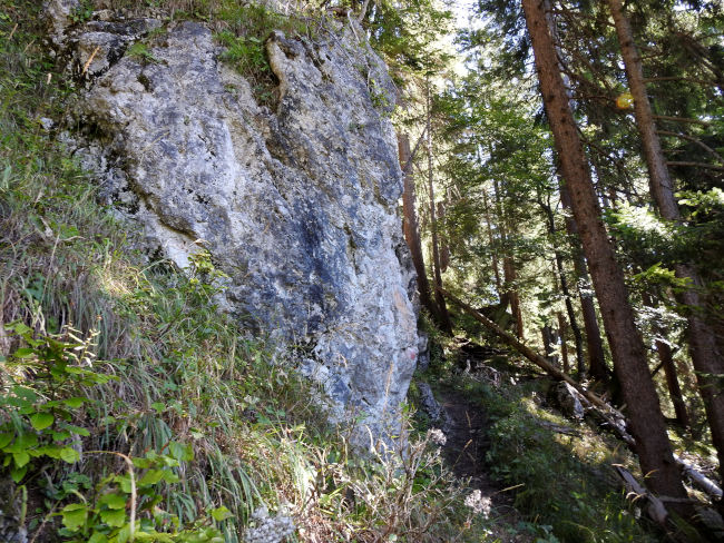
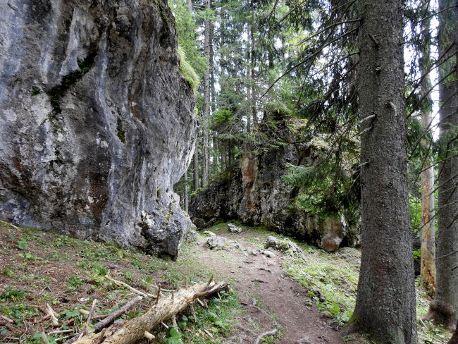
Our narrow hiking trail, which is still lonely, takes us past imposing rock faces and through sun-drenched mountain forest. But the trail also turns out to be a small obstacle course, because from time to time we have to cross logs that lie across the path, climb over root steps or boulders where you wish you had longer legs. And yet such a trail is nicer to run than a wide forest road, even though my muscles would say just the opposite.
Once again, we take a short break in the forest, enjoy a snack and greet a few other passing hikers. A look at the map shows that we must be just below the Kälber Alm and therefore it shouldn't be far to the August-Schuster-Haus, the highest point on the hike. Not knowing that the highest point of today's stage is so far away gives me new strength and energy and so we pack up our stuff again, shoulder our backpack and move on step by step.
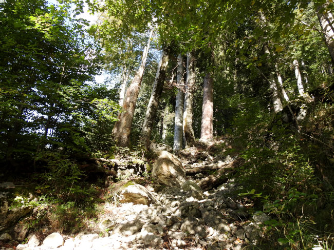
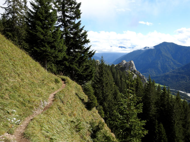
The forest is increasingly thinning and the view is freer both out of the surrounding mountains and up to the summit. The already narrow path is getting narrower and you have to concentrate on the way again instead of enjoying the views, because a wrong step would be fatal here. Once again, this is not the way for people who are afraid of heights. On the last hill, we come to a fork in the road again. We now turn right to Pürschling, which is only 20 minutes away. The trail continues almost straight on now and the August-Schuster-Haus can soon be seen in the distance, but now the first hikers are already meeting us on the narrow path. It is not so easy to get past each other in a limited space.
We did it and are now also at the August-Schuster-Haus. The hut's terrace is fully occupied by hikers who prefer to climb up from Unterammergau. We also meet some familiar faces here again, who also treat themselves to a snack and a drink in the hut. Unfortunately, only the terrace is open today and now it is very windy at the summit and the only 11 degrees can be clearly felt. So we put on our fleece sweater and jacket and look for a somewhat sheltered corner where we can take a last break before we start the descent to Unterammergau. If I had just been in the mood for a cold cyclist after the sweaty climb, I now prefer my warm tea from a thermos in the wind.
After the previously quiet hiking trail from Linderhof Castle, the hustle and bustle here on the mountain is a stark contrast. All sorts of day trippers are on the go, families with children, parents with babies on their backs, smaller hiking groups and also dog owners, although the dogs cannot see the effort of climbing in contrast to their master or mistress. Since easier hiking trails also lead to Pürschling, for example over the Kobelsattel, which can be reached by gondola and only have to climb just under 300 meters in altitude to Pürschling, the mountain is popular with holidaymakers and locals. The forest road up here from Unterammergau is also a lot easier than the path we have just come, especially since neither sure-footedness nor a head for heights are required.
We can now choose whether we want to descend the wide forest path or take the forest trail. The forest trail is more picturesque, so we take the small path accordingly.
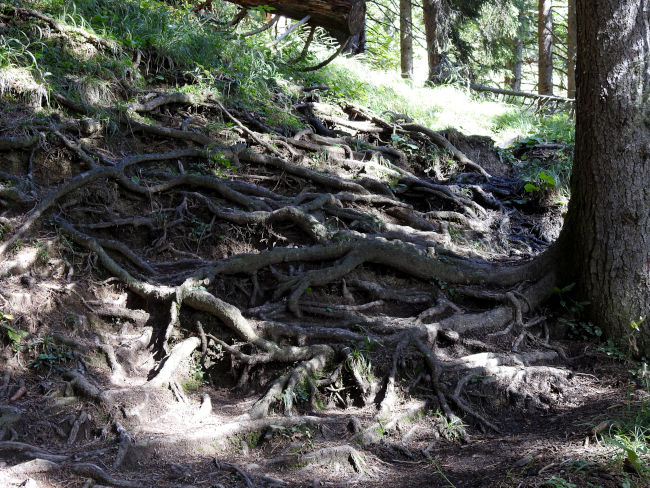
As soon as we have reached the forest line, the hiking trail leads quite steeply downhill over many roots, which have spread over the trails here and can easily become a tripping hazard. Concentration is therefore still required. From time to time, there are some far-reaching views, but the rocks along the way are really impressive, with some trees clinging to and entwining with their roots.
The forest trail comes to an end after a few kilometers and joins the forest road in the immediate vicinity of the Schleifmühlen Alm. You could stop off here again, but the terrace is also very busy late in the afternoon, so we will move our stop to the stage destination. We are now also continuing on a wide forest road. Our trail is accompanied by the rippling of water. We will soon be at the hiking car park and walking past pastures and on to the center of Unterammergau.

The goal has been achieved, we are happy with today's hiking day, but also slightly broken. We are now looking forward to finally resting our feet, eating a large cup of ice cream and then getting back to the car at Linderhof Castle in an easy and comfortable way. We really liked the hiking trail from Linderhof Castle to Pürschling, even though it was a bit exhausting. It is certainly worth running this one time or another in combination with another hiking trail from Pürschling.
Tips & info:
- Route length: 11 km, performance kilometers: 17 km
- Walking time without a break: 3 hours 21 minutes (the time is one for absolute fast runners, because the time on the yellow hiking signs alone is given as a total of 4:15, from 2:30 to Pürschling and 1:45 to Unterammergau, rather give more time than plan too little)
- Altitude: approx. 575 m high, 641 m down, highest point 1,612 m
- Moderately difficult hike (here too I would describe the hike as moderately difficult — difficult, especially compared to stage 9, which is really easy), predominantly mountainous terrain, mostly on narrow, small paths, a head for heights and good sure-footedness as well as good hiking boots and hiking poles.
- Unfortunately, the tourist office only provides an overview map of the Spitzenwanderweg. There is also no digital trail map on the official Spitzenwanderweg website. The best navigation is here.
- Arrival by car: From the Hotel am Badersee via Garmisch-Partenkirchen to Oberau, then turn left to Oberammergau, after Ettal there is the turnoff to Linderhof Castle.
- Public transport: If you want to complete the entire tour by public transport, you should start early, as the journey time is approx. 2:30 hours to 2:50 hours alone to Linderhof Castle (e.g. Eibsee bus at 8:16 AM, bus 9606 at 09:43 AM from St. Irmengard GAP, bus 9622 at 10:47 AM from Klostergasthof Ettal, arrival at Linderhof Castle 11:05)
- Return from Unterammergau to Linderhof Castle: Bus regularly but not hourly with 1-2 changes, travel time 0:50 — 1:21 hours, last trip at 17:34 on weekdays, 16:45 on Saturdays, 15:21 on Sundays.
- Return trip from Unterammergau to the Hotel am Badersee: Duration approx. 1:30 hours — 2:13 hours, 1-3 transfers depending on the time, last possible return 5:34pm/6:33pm, arrival 7:47pm/8:47pm (Sunday/ Saturday). Information under www.bahn.de
- Places to stop for refreshments: August-Schuster-Haus open on the Pürschling between May and the end of October, Schleifmühle Inn and Museum. Check current opening times beforehand.
- The hiking sign of the Spitzenwanderweg is on all yellow hiking signs.
Heartily Wellcome
at Lake Badersee