Top hiking trail stage 12: From Bad Kohlgrub to Murnau

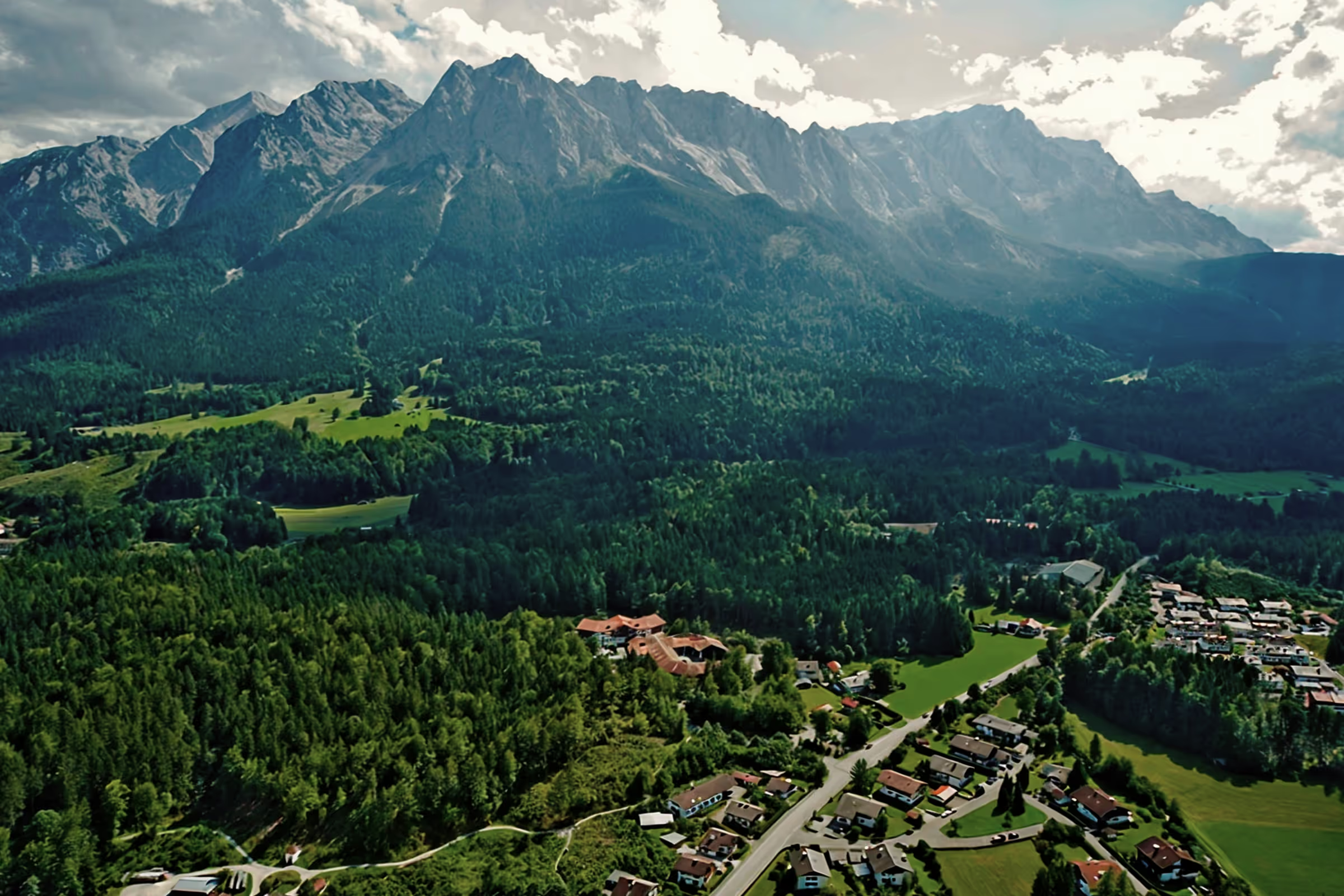
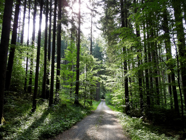
The 12th and last stage of the peak hiking trail is also the longest. 27.1 km must be hiked from Bad Kohlgrub to the destination in Murnau. However, the stage is fairly flat; you only have to climb 140 meters in altitude. From Bad Kohlgrub, the long-distance hiking trail leads through the idyllic foothills of the Alps to the beautiful Staffelsee, past meadows, fields and moorlands. The stage is accessible all year round, but summer time is one of the best hiking seasons, as not only do numerous flowers bloom on the fertile moors, but the Staffelsee also invites you to swim.
Tour profile
Difficulty level: easy to medium
Route length: approx. 30 km
ascents: 140 hm
descents: 280 hm
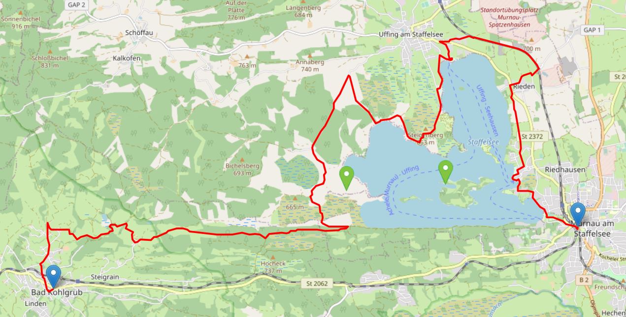
Map © www.ich-geh-wandern.de
Top hiking trail — experience the natural landscape of the Zugspitze region over 200 km
Not too long ago, the Spitzenwanderweg was ceremonially opened. The long-distance hiking trail covers 200 km and 12 stages through the picturesquely diverse landscape of the Zugspitze region. More than 6,800 meters of altitude difference are also covered, so the top hiking trail is quite a sporting endeavor. But it's worth it. Because the trail leads through a diverse landscape and also passes through numerous cultural monuments. The start and end point is the picturesque town of Murnau. Two overnight stays in huts are included on the long-distance hiking trail, once in the Soiern House and once in the Schachenhaus. On the 200 km, hikers pass fantastic views, flower-rich mountain and moor meadows, deep blue mountain lakes, bubbling springs and rivers, the spectacular Partnach and Höllental gorge, foothills of the Alps with far-reaching views, as well as cultural monuments such as the royal castles of Schachen and Linderhof Castle, as well as typical Bavarian villages such as Murnau, Krün, Mittenwald, Grainau or Oberammergau. There is therefore much to experience and discover on the 200 km long trail.
And we too are keen on the long-distance hiking trail and are treading this stage by stage, because the trail will also be a special experience for us locals. I will walk the path partly alone, but also with my colleague. Join us on the hiking trail.
The top hiking trail: All stages at a glance
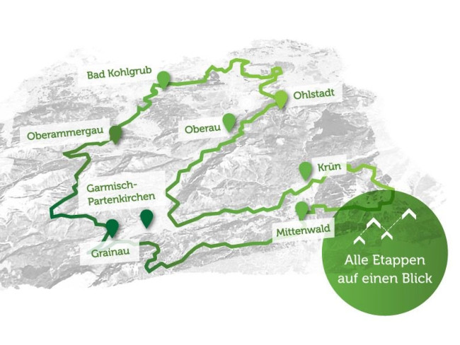
Picture © spitzenwanderweg.de
To stage 11: From Unterammergau to Bad Kohlgrub
Stage 12: From Bad Kohlgrub to Murnau
“The journey is the destination. ”
Confucius, Chinese philosopher, presumably 551 BC - 479 BC
Today the time has finally come, I will hike the last stage of the top hiking trail. Unfortunately I will be traveling alone on this tour, as this stage is too long for both Polly and a friend of mine. On the other hand, I don't mind running 27.1 km. I've already packed my swimsuit in my backpack, because at Lake Staffelsee I'm going to enjoy a refreshing swim in the lake at today's warm summer temperatures. That is really motivating. In addition, I have packed 2.5 liters of water today, a cyclist and enough to eat, because there will be no places to stop off between Bad Kohlgrub and Uffing am Staffelsee and as temperatures are expected to rise high to 29 degrees, it is important to have enough liquid with you. A head covering is just as much a part of my current hiking equipment as sunscreen; after all, a large part of the trail leads over open meadows and bogs that provide no protection from the sun. I then drive to Bad Kohlgrub, where I park in one of the excellent parking spaces and then walk to the starting point of the trail.
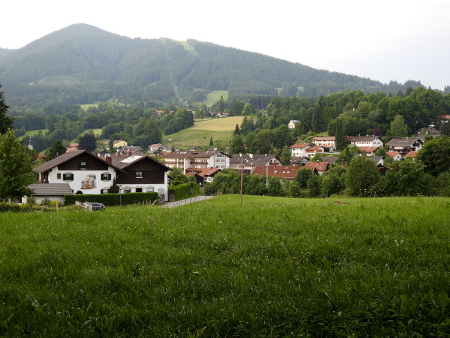
Bad Kohlgrub will soon be behind me and I will be led out of the village past a small chapel. At a fork in the road, I first have to look, because according to the signs, the peak hiking trail takes me back to Bad Kohlgrub. Can that really be the case? I look at the map with the GPS again and in fact the path here makes a very sharp bend to get to the houses in Vorderkehr. Well, you could have done that before, after Bad Kohlgrub, a path turned right to the small settlement on the hill.
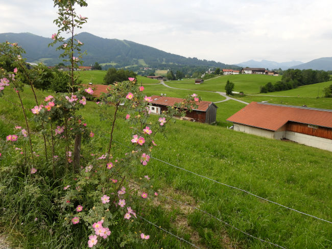
Now it's slightly uphill, wondering whether this is already the 140 meters in altitude that you have to climb on the hike. As quickly as you get into the settlement, you have left it again. The view opens up over vast areas of meadow and I can already see Lake Staffelsee on the horizon. He seems so close and yet so far away from my current position.
At a log shed, the peak hiking trail then turns right onto a mini trail, and shortly afterwards comes back onto a larger forest path, which I continue to follow. After a while, the Rantscher pond appears before my eyes, but it doesn't look like I'm coming near the lake. And in fact, the hiking trail keeps a distance from the water. Now I finally go through a piece of forest, where I see a deer scurrying away, which unfortunately startled me. Too bad, I would have been happy to receive a photo of a deer. I continue along the path to a stream, behind which it splits. On the left, it would also go to Uffing, but the peak hiking trail runs to the right. Apparently, the hiking trail would otherwise be too short if you walked directly to Uffing on the left. After all, a long-distance hiking trail wouldn't be a long-distance hiking trail without taking a few more kilometers along. And so I turn right to get to the Sprittelsberg settlement.
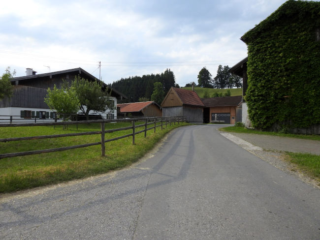
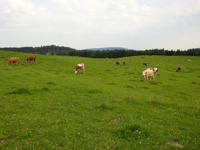
Sprittelsberg consists of only a few farms. This is where the good Berchtesgaden milk is produced, because a company milk transporter has just arrived to pick up new fresh milk from the farmers, which we can then buy in turn at the supermarket. And so it is not surprising that I first pass through pastures where hundreds of cows are currently grazing. “Good milk from the countryside” can only be said. There is plenty of lush grass here and the cows also enjoy lots of exercise.
We're finally heading back to a wooded area. The temperatures are already pretty warm, but at least it's pretty hazy today and so the sun doesn't burn down quite as hot from the sky. But the shadow is obviously good for you. A second encounter with animals makes me pause spontaneously. A big hare hopped on the way from a corner and for a moment we both just look at each other motionless. As I reach for my camera, however, the hare turns around again and zack, he has disappeared into the bushes again. So no luck with animal photos. The cows are already making it easier for me.
In the shady forest, I now also find a quiet place for a break and a first snack. Since I have a blanket with me this time, I lie comfortably on the grass floor, stretch out my legs and listen to the birds sing. But an annoying fly destroys my break idyll in the forest. She pops up in my ear again and again with her annoying buzzing sound. I won't scare her away either. After a while, I give up. What a stupid fly. I repack my blanket and follow the next sign.
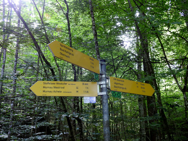
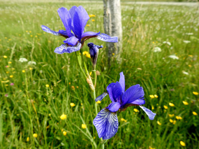
The forest soon opens up and offers a view of vast areas of moor, an indication that Lake Staffelsee is not far away anymore. And indeed, I will soon reach the trail known as the Staffelseerundweg. Here, too, I have the question of why the trail now actually runs left to Uffing instead of right around the lake and directly to Murnau. That would be a good 10 km less to run. But then I remember again: it is a long-distance hiking trail. Emphasis on “remote.” So now I continue on the left on familiar paths. The route to Uffing is now very familiar to me, as I have already walked the Staffelseerundweg from Murnau to Uffing twice. Once again, the meadows with irises and orchids, whose flowering season is just around the corner, are beautiful.
The Staffelseerundweg is about to get a lot more crowded. While I only met very few people from Bad Kohlgrub to the junction at Staffelsee, I now and again pass by cyclists who also take advantage of the beautiful weather and ride the popular Staffelsee trail by bike. It will still be a while before I can actually reach the Staffelsee and finally take my swimming break. The trail first leads some distance to Staffelsee through a nature reserve and nesting ground for birds.
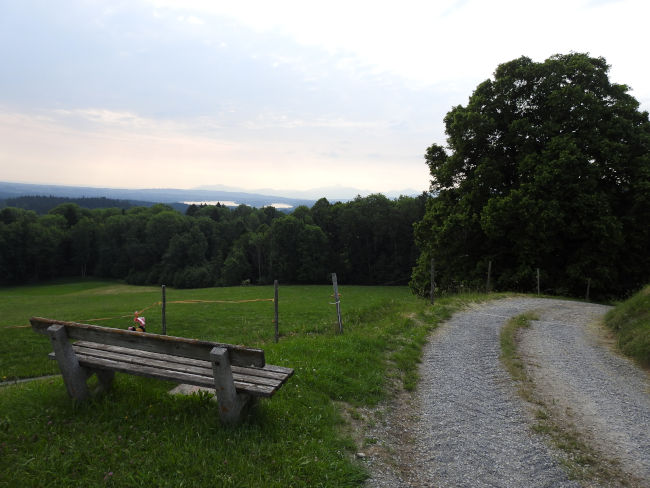
I reach the next fork in the road. Here I would turn left to Bad Kohlgrub, this would probably be the path that would lead me to the junction behind the stream. At the turnoff, a bench invites you to take a break for a short time. Unfortunately, since I have been on the Staffelseerundweg, I have been accompanied by a number of mosquitoes that are constantly flying after me. As long as I'm running, no problem, but as soon as I even stop, they sense the chance of getting some blood from me. So this break is also rather short-lived. Unfortunately, my mosquito repellent doesn't seem to repel mosquitoes. But my swimming spot is not far away anymore and I won't let it be taken away from me. I'm still about 30 minutes away from him. This time I'm even lucky and a squirrel shows up to me in the small stretch of forest that I'm now walking on.
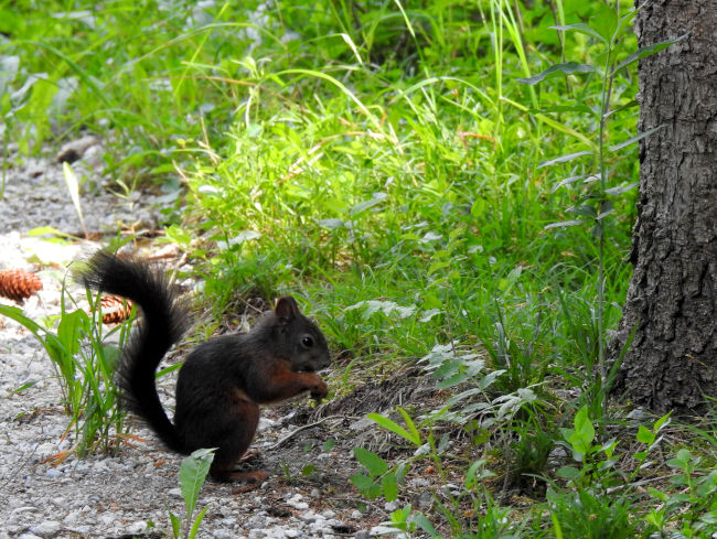
I just manage to take a picture, then it is disturbed by approaching cyclists and jumps up the tree trunk in no time at all. It continues, out of the cooling forest, over meadow paths, then right at the turnoff down to Lake Staffelsee. Oh how I am now looking forward to taking off my clothes, taking off my hiking clothes and diving into the cool water of the lake. Hopefully the lying areas aren't overcrowded yet. In fact, it's already noon. I'm lucky though. I immediately use the first meadow on the riverbank and even find a piece that offers me shade at the same time when I need it. Quickly spread out the blanket, strip off the clothes and it goes into the water. The pleasant coolness of the water is good for me. It takes quite a while until I get to the deep part of the lake, where I can dive straight away with my head.
I just lie in the water for some time, enjoy the coolness and let myself drift. Then it's time to get out of the water, enjoy a snack and a cyclist.
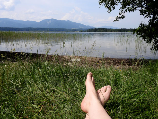
I take a break at Lake Staffelsee for an hour, jump into the water a second time and let the sun dry myself again. Then it can continue again. After all, it is at least 10 km that separate me from Murnau. The bathing areas are becoming more and more crowded and the seaside resort in Uffing is really getting going. Everything is full here. It's good that I took advantage of the first opportunity and was able to enjoy my swimming break in peace. Most tourists and locals stay right near the parking lot and use the meadows here. It only gets lonelier when you run a few kilometers. Me and my buddy prefer the quieter bathing areas and like to walk a bit further in return.
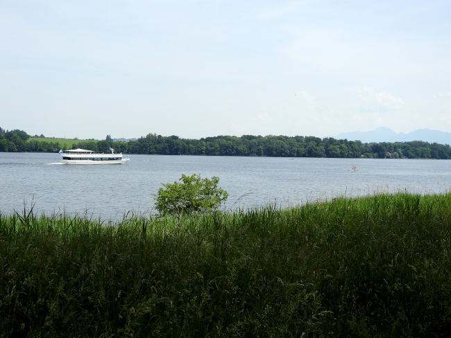
I reach Seerestaurant Alpenblick, a nice inn with a large beer garden, where I also like to be a guest again and again. The ferry has just left the inn and is probably heading back to Murnau. From here on I will now venture into unknown territory again, because the route from here to Murnau is still unknown to me. I therefore continue to follow the signs and take the path that goes up to the federal road at the parking lots. Passing the last houses in Uffing, I continue on the Großer Staffelseerundweg, which is also the top hiking trail.
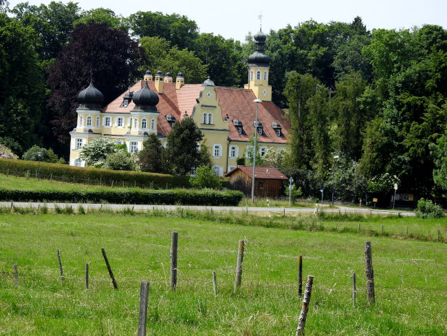
The journey won't be nice though, because I'm running parallel to the railroad tracks. The sun is really popping down from the sky now, I'm happy that I'm wearing my hat and sunscreen on my skin. Because shadows no longer exist. I pass the village of Rieden, near which stands the small Rieden Castle with its distinctive yellow color and towers.
Once again I cross the main road and continue through meadows. But I won't get close to Staffelsee anymore until I reach Seehausen am Staffelsee. The last 7 km of stage 12 were a complete disappointment and I am annoyed myself that I hadn't run or bike the entire relay lake trail before, because then I would have saved myself those kilometers straight away. The route from Uffing to Murnau was anything but worth seeing, offered hardly any nice views and also ran far away from the shores of Lake Staffelsee. Taking the ferry from Uffing to Murnau would certainly have been more exciting. In the end, I'm just happy to get to the train station and take the train back to Bad Kohlgrub.
I have completed the last stage of the top hiking trail and am now looking forward to just relaxing my feet. What began beautifully did, in my opinion, not end well. There is certainly a better route than the 7 km from Uffing to Murnau. A recommendation can be found under Tips & Information.
Tips & info:
- Pure walking time: approx. 06:15 hours
- Mostly field and forest trails, good comfortable shoes are recommended.
- The trail is also easy to cycle. There are a few bumpy spots between Bad Kohlgrub and the turnoff to the Staffelsee circular trail.
- Places to stop for refreshments: Seerestaurant Alpenblick in Uffing am Staffelsee, otherwise again in Murnau.
- Bring enough food and drinks for the tour. In hot weather, be sure to cover your head and protect yourself from the sun, as the route offers little shade. Bug spray needed, especially near the lake.
- Swimming: Please only on the specified swimming areas at Staffelsee, otherwise at Strandbad Uffing or in Murnau.
- You can really save yourself the last 7 km of the hiking trail from Uffing to Murnau. We recommend taking the following alternative routes:
- When you get to the branch of the Staffelsee circular trail from Bad Kohlgrub, you can walk the Staffelseerundweg straight to Murnau (approx. 7-10 km shorter).
- Take the ferry from Seerestaurant Alpenblick back to Murnau. Shipping also offers the opportunity to experience Lake Staffelsee from a different perspective. Here the timetable.
- How to get there: By car to Bad Kohlgrub. There are various free parking options in the center. Alternatively, travel by public transport. From Hotel am Badersee, take the Eibseebus to Garmisch-Partenkirchen train station or Untergrainau station. From there take the train to Murnau, here change to the train to Bad Kohlgrub (bahn.de)
- Departure: Take the train from Murnau back to Bad Kohlgrub or directly back to Garmisch-Partenkirchen or Untergrainau and take the Eibseebus back to the hotel on Lake Badersee.
Heartily Wellcome
at Lake Badersee