Top hiking trail stage 2: From Eschenlohe to Garmisch-Partenkirchen

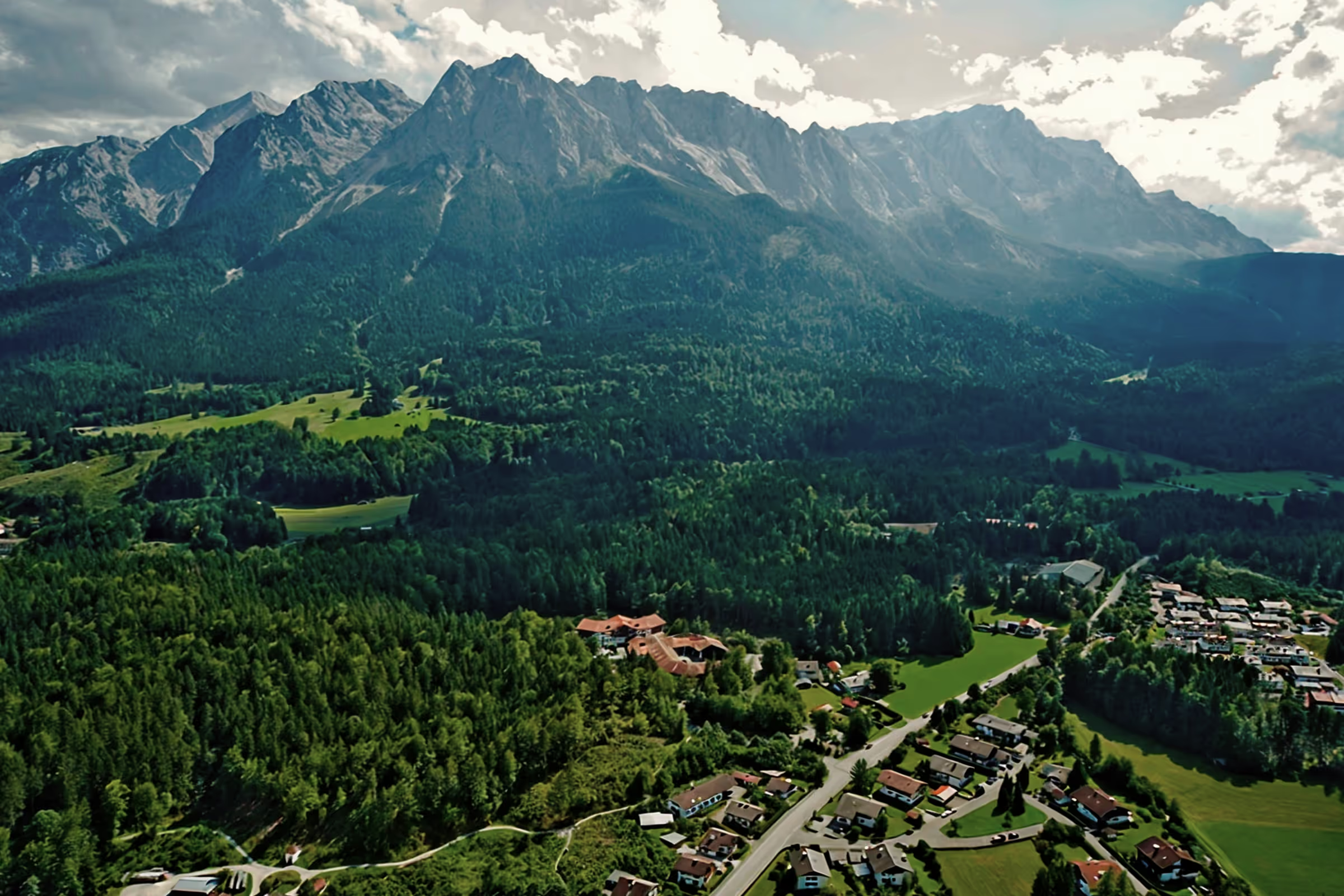
The second stage takes long-distance hikers to Garmisch-Partenkirchen. The approximately 16 km long route leads mainly through meadows and moss areas, past the famous seven springs. If you want, you can take a detour to the Kuhfluchtwasserfälle, one of the highest waterfalls in Germany. And the fantastic alpine panorama is almost always in front of your eyes. Let's go!
Tour profile
Difficulty level: easy
Route length: approx. 21 km
ascents: 75 meters
descents: 0 m
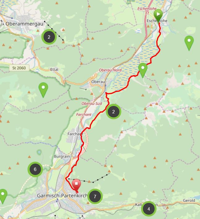
Map © www.ich-geh-wandern.de
Top hiking trail — experience the natural landscape of the Zugspitze region over 200 km
Not too long ago, the Spitzenwanderweg was ceremonially opened. The long-distance hiking trail covers 200 km and 12 stages through the picturesquely diverse landscape of the Zugspitze region. More than 6,800 meters of altitude difference are also covered, so the top hiking trail is quite a sporting endeavor. But it's worth it. Because the trail leads through a diverse landscape and also passes through numerous cultural monuments. The start and end point is the picturesque town of Murnau. Two overnight stays in huts are included on the long-distance hiking trail, once in the Soiern House and once in the Schachenhaus. On the 200 km, hikers pass fantastic views, flower-rich mountain and moor meadows, deep blue mountain lakes, bubbling springs and rivers, the spectacular Partnach and Höllental gorge, foothills of the Alps with far-reaching views, as well as cultural monuments such as the royal castles of Schachen and Linderhof Castle, as well as typical Bavarian villages such as Murnau, Krün, Mittenwald, Grainau or Oberammergau. There is therefore much to experience and discover on the 200 km long trail.
And we too are keen on the long-distance hiking trail and are treading this stage by stage, because the trail will also be a special experience for us locals. I will walk the path partly alone, but also with my colleague. Join us on the hiking trail.
The top hiking trail: All stages at a glance
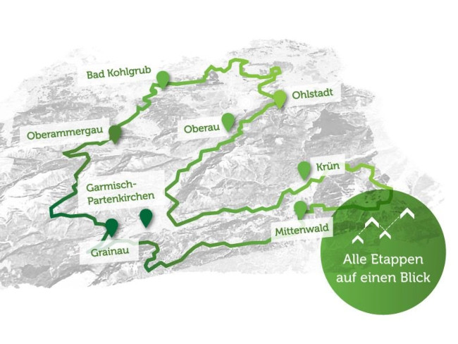
Picture © spitzenwanderweg.de
To stage 1: From Murnau to Eschenlohe
Stage 2: From Eschenlohe to Garmisch-Partenkirchen
“Hiking is an activity of the legs — and a state of the soul. ”
Josef Hofmiller, German writer and Nietzsche researcher, 1872 — 1933
The very next morning I start stage 2 of the peak hiking trail. Since the stage ends in Garmisch-Partenkirchen, I travel comfortably by train to Eschenlohe. At 09:25 I arrive in Eschenlohe and walk from the train station to the starting point of stage 2, which is just behind the bridge. This morning will be very sunny again and at 9:30 I can already feel the warm temperatures on my skin. It was still raining heavily during the night, the air is correspondingly humid and rain is forecast again in the late afternoon, early evening, but by then I will be sitting comfortably at home again.
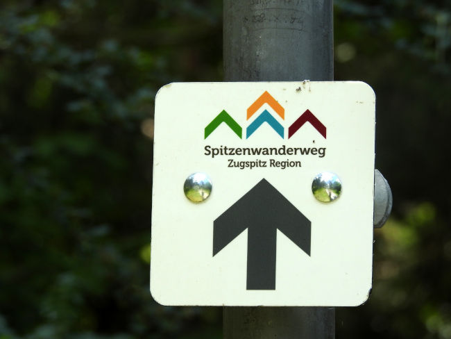
Behind the bridge, I come across my hiking sign again, which shows me the way. I will soon leave the last houses in Eschenlohe behind me and follow the field and meadow path. The view is already gigantic. The alpine panorama is clearly visible, not a single cloud obstructs the view. Although I get to see the mountains every day, I can't get enough of this panorama. It is simply fascinatingly beautiful. Just a few kilometers to Eschenlohe, the top hiking trail offers the first highlight: the Seven Springs in Eschenlohe.
From the dirt road, the wide Mühlbach, which looks more like an elongated lake and is formed from the streams and ponds of the Seven Springs, is easy to see. The area is fenced, I suppose to protect water birds that you can see swimming on the river from afar. However, the beauty can be seen from afar. However, just before the trail leads into the forest, it is possible to get close to the water. The mountains are beautifully reflected in the turquoise-blue water. And that is just the beginning of the hike.

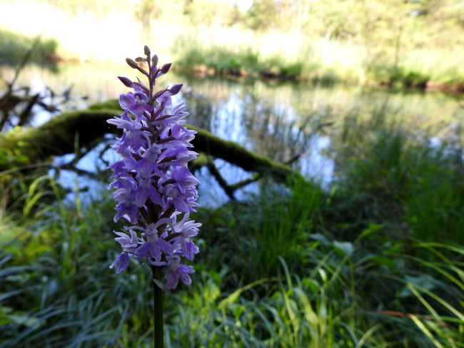
I dive into the forest now, cooling shade surrounds me again, the birds are chirping in the trees, but once again prefer to remain hidden. A number of orchids of the broad-leaved orchid variety bloom between the trees. I reach the official site of the Seven Springs. More than 1,500 liters of water flow out of the karst springs every second. The crystal-clear spring water collects in basins and ponds, from which flows the wide Mühlbach, which flows into the Loisach near Eschenlohe. There is also an information sign here. A couple of children who are currently hiking with their parents enjoy putting their feet in the cool water of the Seven Springs. I'm sure the water is pretty cold. But as a child, I think, you have a different feeling of cold. I can remember jumping into the cool sea faster as a child than I do now as an adult.
Trees and shrubs initially determine the landscape on my right and left sides. The sprawling Prühlmoos is hidden behind the trees. However, the forest thins out from time to time and allows you to see the surrounding mountains in the background and also see more of the moss. The B2, which leads to the motorway, runs on the other side of the moss. Seen from the expressway, you can't even imagine the beauty of the path I'm on now.
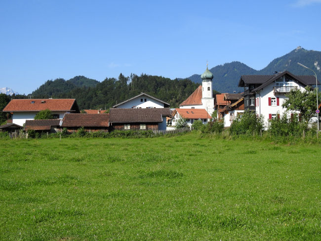
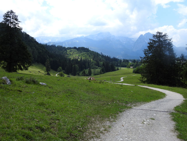
Shortly before Oberau, the view opens again and the long-distance hiking trail leads through open meadows, which are framed by the high mountains. The paved road is not only popular with cyclists, but also with rollerbladers, who also like to use this section of the route as a training track for winter cross-country skiing. Before Oberau, I pass the Garmisch-Partenkirchen Golf Club, which is also well visited due to the summer temperatures.

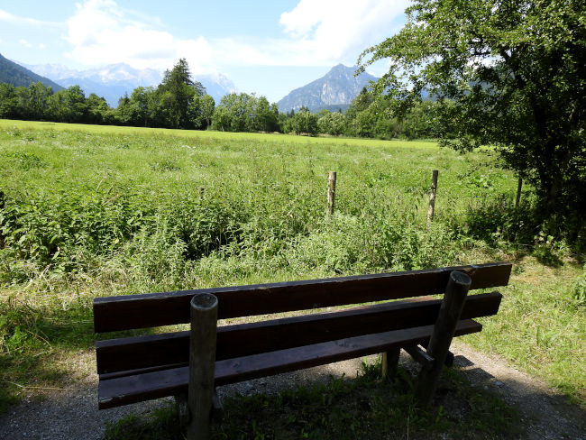
However, before it enters the village of Oberau, the Spitzenwanderweg branches off to the left and leads away from the village in a sharp triangle, out into the meadows and fields. It is absolutely busy here. 95% of cyclists are out and about, as a hiker, I almost feel out of place here. Behind Oberau, there is a vacant bench with a fantastic view under a tree. I'm going to incorporate this for now and give myself a break.
While the cyclists cycle behind me on mountain bikes, e-bikes and racing bikes towards Garmisch-Partenkirchen or even towards Eschenlohe, I enjoy the view from my bench, drink my water and enjoy my snack. Sometimes I wonder whether cyclists perceive the landscape as intensely as I do. I am of the opinion that walking is more like absorbing nature, discovering a bird or even a squirrel in the trees and also listening to all the sounds of nature.
After 20 minutes, my feet feel rested to run the next distance. After Farchant, I would like to enjoy another longer break, until then it's time to march, march and march again. However, this is very easy when it comes to views.
Only the hard tar soil bothers me, but before Farchant, the peak hiking trail branches off the cycle path to the left and leads on now natural soil through a beautiful natural landscape characterized by pine trees. There are also no cyclists around here anymore and that feels really good. Not that I have anything against cyclists, but now I don't have to look behind me when I change sides of the trail.

I slowly but steadily approach Farchant and cross the path that leads to the impressive cow escape waterfalls, which are among the highest in Germany. Since I already know the cow escape waterfalls, I don't need to make a trip there today. However, if you haven't seen them yet, you should accept this detour, because the waterfalls are really worth seeing and the trail, which leads a bit steeply to the viewpoint, is also peppered with smaller waterfalls. For me, it goes further into the village. I don't have to go to the town center, because my hiking trail leads past the Farchant hydroelectric power plant to the Philosophenweg.
The Philosopher's Trail marks the last stretch of the hike from Farchant to Garmisch-Partenkirchen. The path itself Create your own hiking trail, which many locals use for walks, short hiking tours or fitness trails for jogging. There are many benches along the way for a rest, and I'm now settling down on one of them in a wooded area for my second snack.
While I listen to bird calls and can make out some hikers whose voices and steps I can already make out from a distance, I am now enjoying my chilled, non-alcoholic cyclist. The cyclist gives me energy again in no time and awakens new spirits in me. A bottle is a staple for every longer hiking trip I go on. For some it may be coffee, for others a cola or an energy drink, for me it's the cyclist. Then it's time to go back and head home to Garmisch.
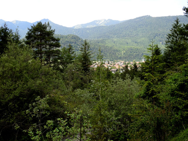
The Philosophenweg is well-known terrain, I've walked here very often with my mother, alone or visiting with a friend. My eye soon sees Garmisch-Partenkirchen's houses in the horizon. However, the cloud cover is increasing more and more, it is no wonder that rain is expected in about 2 hours, although it is still quite weak, but there is still a lot to come down towards the evening. All the better when I'm back home by then and can make myself comfortable.
The ruins of Werdenfels Castle come to my attention, then I also pass the shooting house, whose terrace is well occupied at this time. Just a few hundred meters straight ahead and I'll come to the turnoff at St. Anton Chapel. Here I descend to Partenkirchen.
From Partenkirchen, I go straight to the train station. I am in the mood for ice cream now and there is an ice cream parlour in front of the train station where I would like to buy a few scoops of ice cream on a cone. Hmm, I'm really looking forward to it now and after all the kilometers I've really earned it. That is my reward for another great hiking day on the top hiking trail. In theory, I could walk all the way to Grainau now, but since the Eibseebus is coming in a few minutes, I'm happy to take this one. You don't have to overdo it then.
tips:
- Route length: 16 km, performance kilometers: 21 km
- Walking time without a break: approx. 4 hours 16 minutes
- Moderately difficult hike, mostly hilly terrain, mostly on field and forest trails and paved roads.
- Unfortunately, the tourist office only provides an overview map of the Spitzenwanderweg. There is also no digital trail map on the official Spitzenwanderweg website. The best navigation is therefore here.
- Travel by public transport: Eibsee bus from Hotel am Badersee to Garmisch train station, from there take the regional train back to Eschenlohe. On the way back, you can also take the Eibsee bus from Partenkirchen and don't necessarily have to walk back to the train station.
- The hike is possible all year round, and this stage can be hiked even in winter.
- There are restaurants in Oberau as well as in Farchant
- The tour is wonderful to share, Eschenlohe to Oberau or Eschenlohe to Farchant, then back to Eschenlohe by train. From Oberau to Garmisch-Partenkirchen or Farchant to Garmisch-Partenkirchen. Here too, you can easily get there by train.
- In summer, be sure to bring sunscreen and, if necessary, a head covering, as larger sections are without shade.
Heartily Wellcome
at Lake Badersee