Top hiking trail stage 3: Through the Partnach Gorge from Garmisch-Partenkirchen to Krün

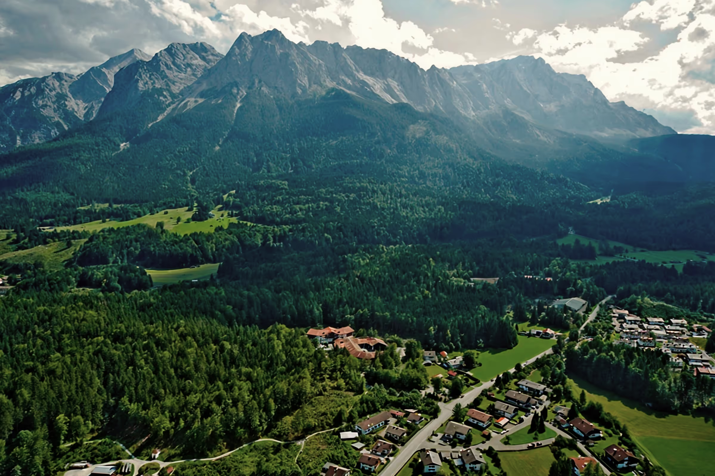
The third stage of the top hiking trail once again offers several highlights and fantastic views over its 25 km. Starting with the impressive Olympic ski jump in Garmisch-Partenkirchen, through the unique natural spectacle of the Partnach Gorge to the magnificent mountain panoramas of the Wetterstein Mountains as well as the Karwendel Mountains. Over 25 km, there is therefore a lot to discover and experience again.
Tour profile
Difficulty level: difficult
Route length: approx. 36 km
ascents: 1,000 hm
descents: 800 hm
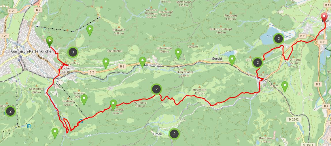
Map © www.ich-geh-wandern.de
Top hiking trail — experience the natural landscape of the Zugspitze region over 200 km
Not too long ago, the Spitzenwanderweg was ceremonially opened. The long-distance hiking trail covers 200 km and 12 stages through the picturesquely diverse landscape of the Zugspitze region. More than 6,800 meters of altitude difference are also covered, so the top hiking trail is quite a sporting endeavor. But it's worth it. Because the trail leads through a diverse landscape and also passes through numerous cultural monuments. The start and end point is the picturesque town of Murnau. Two overnight stays in huts are included on the long-distance hiking trail, once in the Soiern House and once in the Schachenhaus. On the 200 km, hikers pass fantastic views, flower-rich mountain and moor meadows, deep blue mountain lakes, bubbling springs and rivers, the spectacular Partnach and Höllental gorge, foothills of the Alps with far-reaching views, as well as cultural monuments such as the royal castles of Schachen and Linderhof Castle, as well as typical Bavarian villages such as Murnau, Krün, Mittenwald, Grainau or Oberammergau. There is therefore much to experience and discover on the 200 km long trail.
And we too are keen on the long-distance hiking trail and are treading this stage by stage, because the trail will also be a special experience for us locals. I will walk the path partly alone, but also with my colleague. Join us on the hiking trail.
The top hiking trail: All stages at a glance
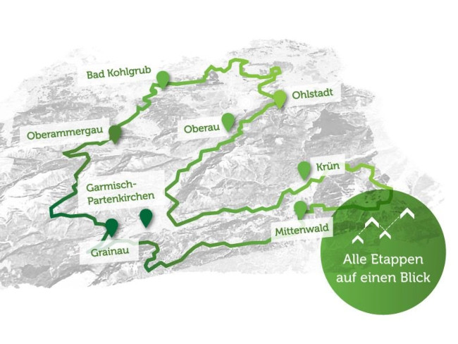
Picture © spitzenwanderweg.de
To stage 2: From Eschenlohe to Garmisch-Partenkirchen
Stage 3: From Garmisch-Partenkirchen to Krün
“Hiking is my source of energy! ”
Gerlinde Kaltenbrunner, Austrian mountaineer, *1970
Today I am not hiking alone, but am traveling with my colleague Polly to embark on the third stage of the top hiking trail together. From the third stage, the top hiking trail slowly becomes more alpine and the first meters of altitude, 1,009 m in total, are to be climbed along the way. We'll meet at the ski stadium in Garmisch-Partenkirchen at 07:45 because there won't be as many people in the Partnachklamm gorge early in the morning. The gorge itself opens at 08:00 at this time of year.
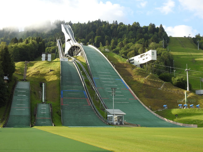
We have both packed enough food and drinks for today, even though we are planning to eat one or more lodges. However, it is better to always have enough with you. Before we start, let's take another look at the Olympic ski jump, which becomes the Mecca for German Eagles and other ski jumping nations on 01/01 of every year. It is still very quiet here now, but during the day, many visitors will also take a closer look at the Olympic ski jump on a guided tour.
It's getting started. We walk the way to the Partnach Gorge. We're not the first hikers out in the morning, some groups of girls are also on their feet. Where did all the boys go? Today really seems to be Women's Day.
Before the last branch to the Partnachklamm gorge, it's time to say goodbye to Polly. While it has already crossed the Partnach Gorge several times, I have actually never managed to visit the gorge in summer. So Polly will be walking around outside while I'm taking the official route through the Partnach Gorge. At the end, we will meet again to continue hiking together.
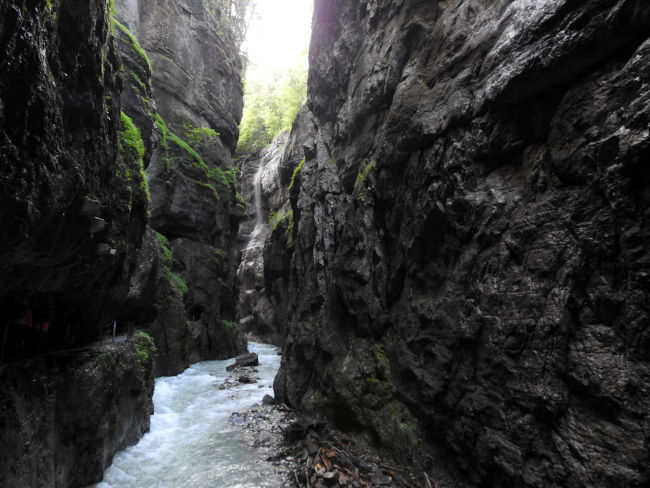
At the entrance I pay the entrance fee of 6 euros and enter the gorge. It is still pretty quiet, so I can stop again and again for a few photos without anyone already pushing behind me. In winter, the Partnach Gorge impresses with its gigantic ice formations, now in summer, I feel the power of the water in the gorge, which flows thunderously between the narrow rocks. In some places it dribbles down a lot and I try to get through the gorge somewhat dry.
While the main route continues into Reintal at the exit, direction Bockhütte, Zugspitze, Schachen and Meilerhütte, I follow the signs to the left to Graseck. On the first few meters in altitude, Polly suddenly meets me. You could actually have waited at the Kaiserschmarrn-Alm or at the Hotel Das Graseck, because that's where our way passes anyway. As a result, she ran a few more meters. Well, Polly is very sporty and a few meters more or less doesn't matter to her. After about 15 minutes behind the Partnachklamm gorge, we reach the Kaiserschmarrn-Alm, which is still closed but will soon open its doors to today's hikers and hut lovers.
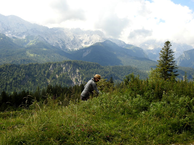
Behind the Hotel Das Graseck, our path turns right and goes up to the corner builder. We are now facing an increase here. We're both running this path for the first time and we wouldn't have thought that there would be so many loops that we climb higher and higher to get to the corner builder. In between, I almost thought I could see the light at the end of the tunnel and thus the end of the climb, but then it just goes up loop by loop. While Polly seems to master the climb wonderfully as a prospective mountain ranger, I have to loosen my legs from time to time because my back muscles are slowly starting to complain.
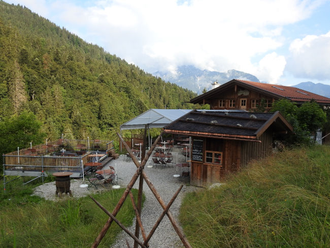
Fortunately, every climb comes to an end and therefore we also reach the corner builder. Our timing is excellent, because Berggasthof Eckbauer is just opening up and so we decided to stop right here for a first break. We're not the only ones with this idea either; the terrace quickly fills up with morning hikers.
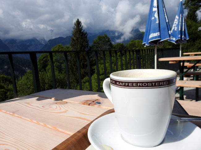
With coffee, tea and a first refreshment, our muscles relax after the climb. The mountains are still a bit cloudy, but the view is fantastic, the sun is shining and it is simply beautiful. And after just two hours, we have completed the most strenuous part of the hike. There are still a few climbs, but they won't be as dramatic then. So we're packing our seven things again and moving on.
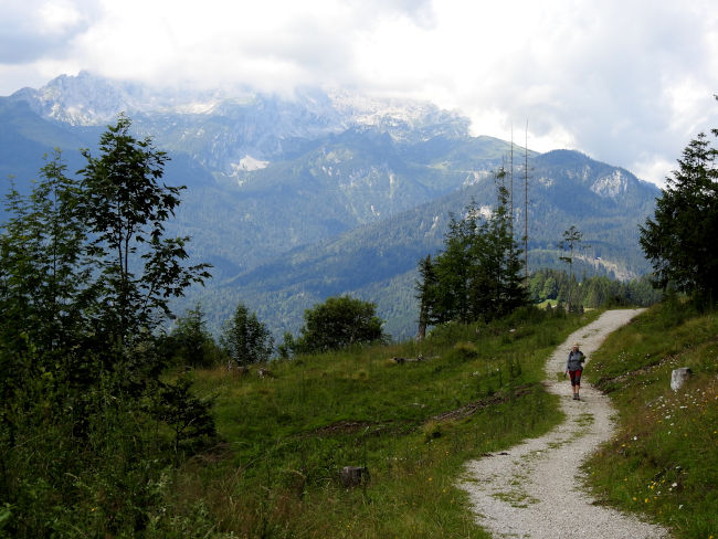
Passing the Eckbauer gondola, we now follow the path towards Wamberg, which you also in several ways achieved. Unfortunately, there is already no sign of the Spitzenwanderweg sign, which has only appeared once in front of the Partnach Gorge. So we stick to the other hiking signs. It's getting lonelier again behind the corner builder. We reach another intersection. Here, too, there is no sign of the Spitzenwanderweg. We must walk straight ahead. On the left, it descends to the village of Wamberg, and straight ahead is the sign for the high-altitude trail to Elmauer Alm. It's good that we also looked at the map with the waypoints beforehand. First through the forest, it soon thins out and reveals a panoramic view of the mountains.
Polly soon gets into a collector's mood, as tons of fresh mint grow along the way. You could use it to make a delicious mojito, ice-cold mint-lemon water or even a warm mint tea. It's good that we have packed a bag that is now being used, because in just a few minutes we filled it with mint leaves. However, we still have to wait for the drink, because you can only conjure something out of mint at home.
Passing some grazing cows, one of which has once again chosen the hiking trail and we therefore have to scare them aside a bit, our trail continues comfortably towards Elmauer Alm. We have now left all the climbs behind us and things are going downhill. We have to check for our right path a few times, as not even the peak hiking trail sign has appeared yet.
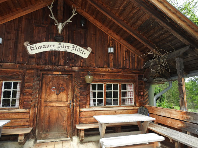
But we're on the right track and finally reach Elmauer Alm, just in time for lunch time to stop by. The disappointment is immediate when a little boy tells us as soon as he walks in that the alpine pasture is closed. That's probably it with a hearty lunch and a cool cyclist. The terrace of the alpine pasture has nevertheless become a break for numerous other hikers, who probably also expected a stop for a break. But a good hiker always has a plan B. And so of course I also have an ice-cold cyclist in my backpack and we both still have snacks that we can now eat in peace and quiet. Hopefully, we will then be able to catch up on our hearty meal at Lake Barmer.
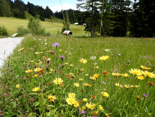
Well rested and filled up with enough sun, we're on our way again. We are now halfway through the route, Kranzbach is not far away anymore and the hiking trail continues leisurely downhill past woodlands and open meadows with numerous flowers, which we study with the help of an information board. We have already discovered several types of orchids on our way and also the beautiful gentian, which blooms in the meadows here until August.
We will soon reach Kranzbach Castle. Before entering the hotel, the path turns left. There is actually another sign of the top hiking trail here. Oh wonder, on stages 1 and 2, the trail was better marked. From Kranzbach Castle, we take a forest trail to the village of Klais. Here it is time to cross the main road. Unfortunately, we have to walk along the main road until just before the gas station, then the trail branches off again and we follow the signs to Grubensee and Barmsee. Here we dive back into the forest. Instead of car engines, birdsong once again determines the background noise. On this journey, too, we are almost back among ourselves until voices of people flock to us from afar.
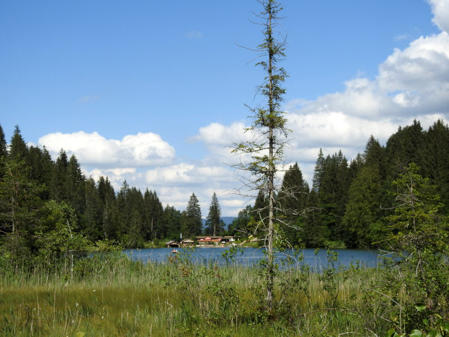
The Grubensee, a popular swimming lake for locals, is not far away. But if we would have thought that our path would be close to the lake, we will be taught otherwise. Apart from one corner, we don't get to see much of the lake. Trees separate the view. This keeps bathers cut off from hikers.
Even without a peak hiking trail sign, we find our way to Alpengasthof Barmsee, which we are now heading for directly, because this is where we should come to our culinary highlight on the hike today. We find a place on the terrace and sit down. A large cooling drink has already been ordered while we take a look at the menu.
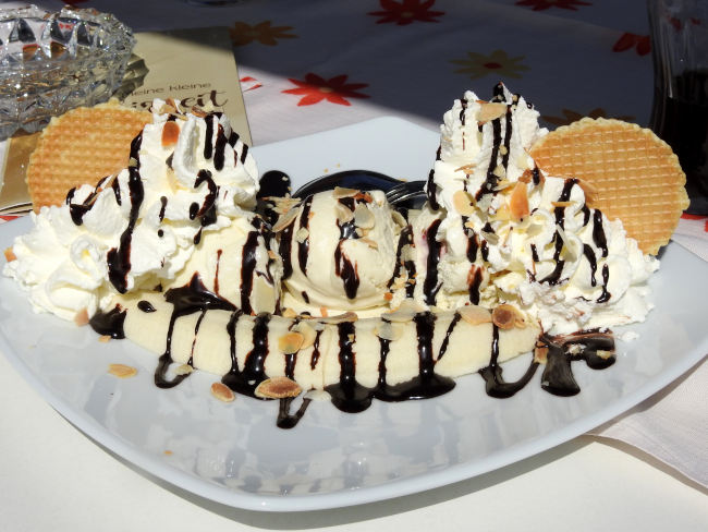
But in the afternoon, there is only a small menu and unfortunately there is no suitable offer for us. With a pizza or a big dumpling in our stomach, it's hard to imagine continuing to run. We're not really in the mood for soup either. So Polly dispenses with everything, for me it must at least be ice cream. With over 1,000 calories already burned, I've earned it now and we still have to run a few kilometers. So I order a banana split that also looks great.
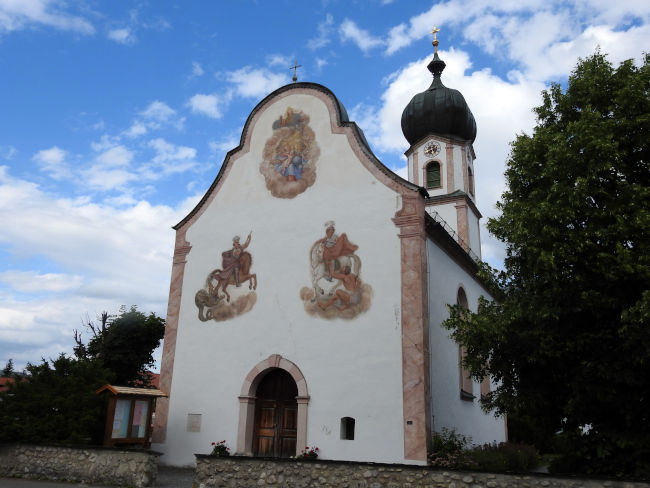
That's when we're ready for our home straight again. We are only a maximum of 1 hour away from the stage destination. Even a hiking sign shows us the way again, but only as far as the first intersection, then it's over again. But since we've looked at the map again beforehand, we know that we have to walk up to the chapel and from there take the bus route — buses we've really done enough already — to Krün. At the end, we cross under the main road through an illuminated one! Pedestrian tunnel and then we can already see the houses of Krün in front of us. The stage destination is at the church. Stage 4 then starts from here.
We are now taking the bus back to Garmisch-Partenkirchen. And since we still have to catch up on a culinary highlight, we decide to reserve a table at a good restaurant in Garmisch so that we can end our stage together in a festive way. Now that we can completely relax, we can clearly notice our muscles, which have worked fully today. But today's hiking experience trumps any suffering that we will feel in our bodies now or tomorrow. It was nice again!
Tips & info:
- Route length: 25 km, performance kilometers: 36 km
- Walking time without a break: approx. 7 hours 6 minutes
- Altitude approx. 1,009 m high, 920 m down, highest point 1,302 m
- Moderately difficult hike, mostly hilly terrain, mostly on field and forest trails.
- Unfortunately, the tourist office only provides an overview map of the Spitzenwanderweg. There is also no digital trail map on the official Spitzenwanderweg website. The best navigation is therefore here.
- Public transport: Eibsee bus from Hotel am Badersee to Garmisch-Partenkirchen City Hall, from there take bus line 1 to the ski stadium. Return by bus 9618 from the town center of Krün to Garmisch-Partenkirchen City Hall and from there by Eibsee bus back to the hotel on Lake Badersee. If you have parked the car at the ski stadium, take bus 9608 from Krün town center to Haupt/Dr.Wigger-Straße in Garmisch-Partenkirchen, then take bus line 2 back to the ski stadium.
- Parking at the ski stadium for a fee. Hiking car park in Krün is also subject to a fee.
- Places to stop for refreshments: Kaiserschmarrn-Alm, Berggasthof Eckbauer, Elmauer Alm, Barmsee Alpengasthof
- The tour can be wonderfully abbreviated: anyone who already knows the Partnach Gorge can take the Graseck gondola to the Hotel Das Graseck. You can save yourself the climb to Eckbauer if you take the Eckbauer cable car up the mountain. If you want, you can end the tour in Klais and from there take the regional train back.
- Sturdy hiking boots, plenty of food, especially drinks, sunscreen and head covering in summer are appropriate.
- The hiking sign of the Spitzenwanderweg is barely available on the route. Please follow the hiking signs (Graseck — Eckbauer — Wamberg — Elmauer Alm via Höhenweg — Kranzbach — Gruben/Barmsee — Krün) or use the navigation aid from ich-geh-wandern.de.
Heartily Wellcome
at Lake Badersee