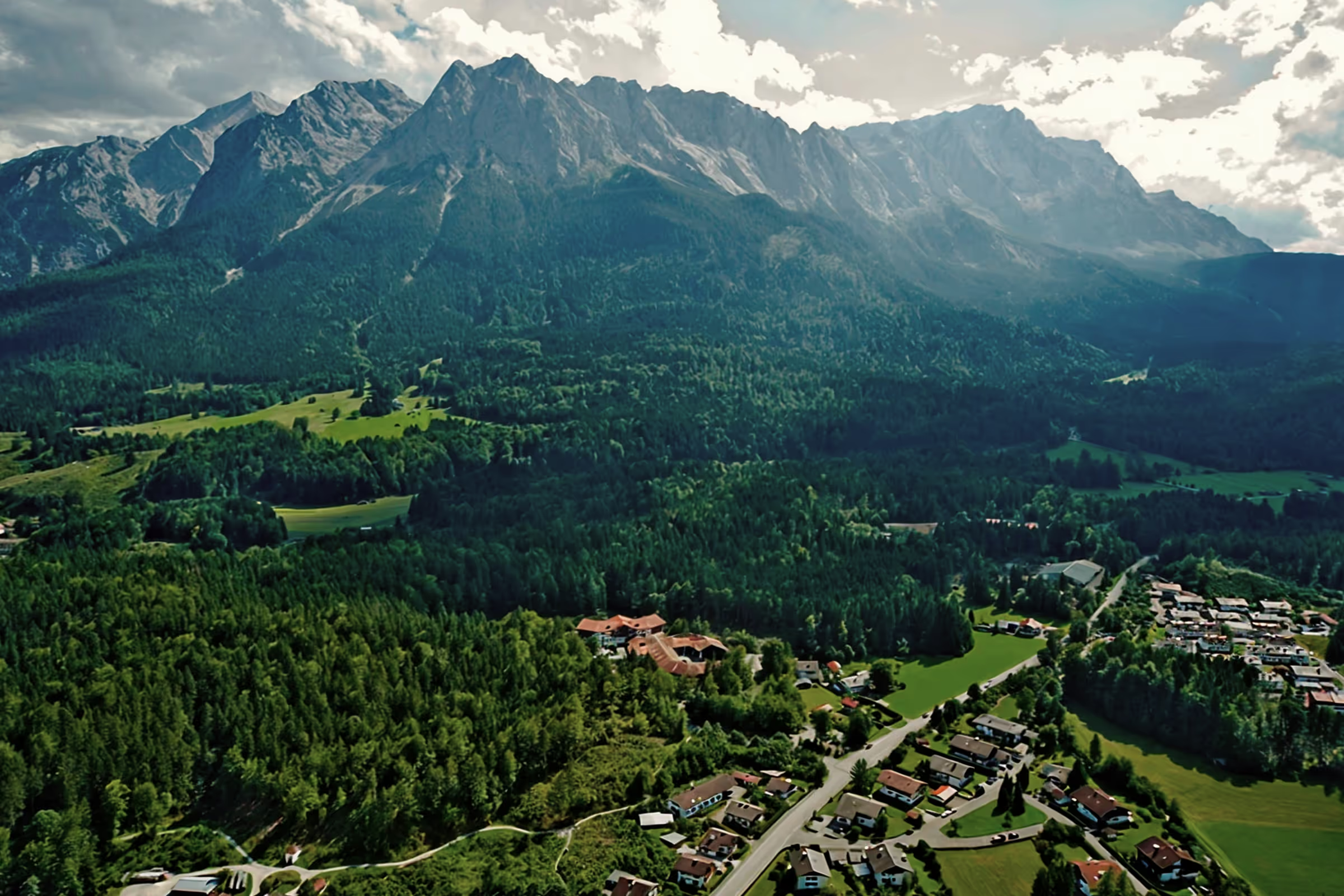
Top hiking trail stage 6: From Mittenwald to Schachen

The sixth stage of the peak hiking trail leads from Mittenwald up to Königshaus am Schachen, one of the royal castles of the fairytale king Ludwig II of Bavaria. The Königshaus am Schachen is located at 1,866 m and can only be reached by shank's mare or by mountain bike, making it a special attraction. In addition, stage 6 must be combined with stage 7 and an overnight stay in the chess house is necessary. Accordingly, a very special hiking experience awaits hikers on these stages.
Tour profile
Difficulty level: difficult
Route length: approx. 26 km
ascents: 1,200 hm
descents: 600 hm
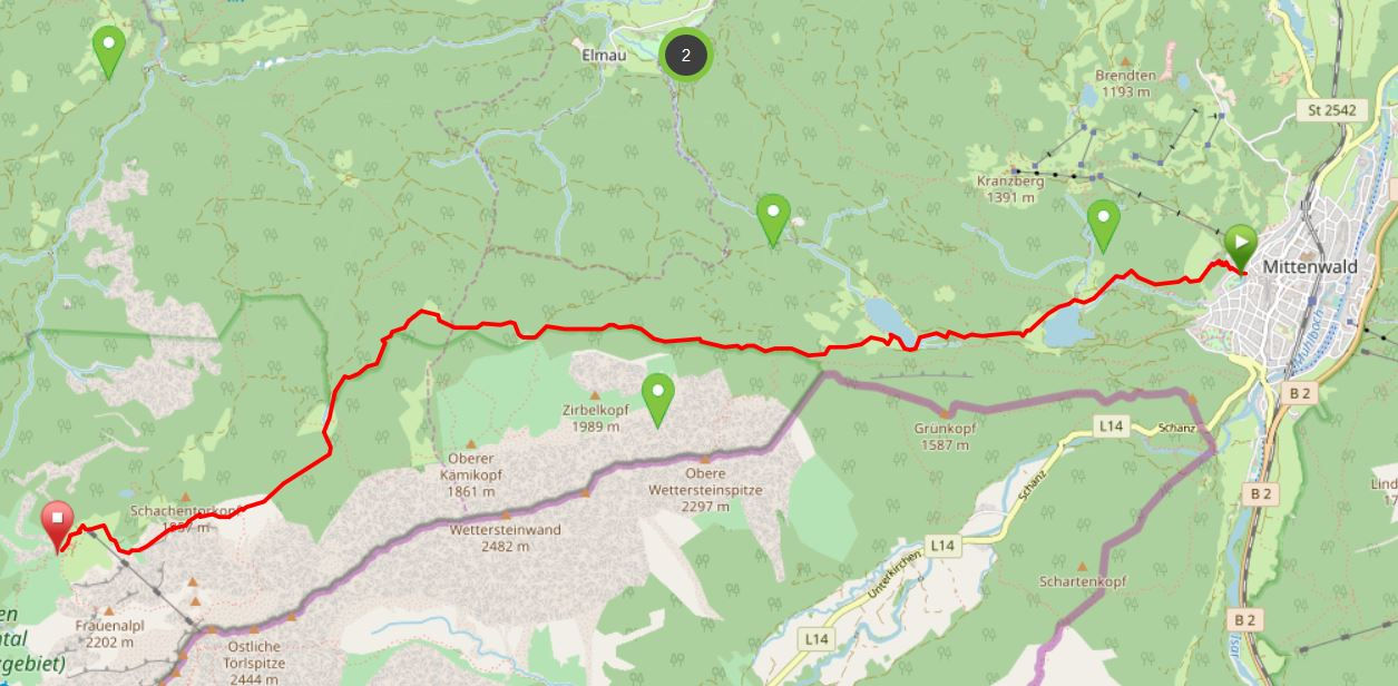
Map © www.ich-geh-wandern.de
Top hiking trail — experience the natural landscape of the Zugspitze region over 200 km
Not too long ago, the Spitzenwanderweg was ceremonially opened. The long-distance hiking trail covers 200 km and 12 stages through the picturesquely diverse landscape of the Zugspitze region. More than 6,800 meters of altitude difference are also covered, so the top hiking trail is quite a sporting endeavor. But it's worth it. Because the trail leads through a diverse landscape and also passes through numerous cultural monuments. The start and end point is the picturesque town of Murnau. Two overnight stays in huts are included on the long-distance hiking trail, once in the Soiern House and once in the Schachenhaus. On the 200 km, hikers pass fantastic views, flower-rich mountain and moor meadows, deep blue mountain lakes, bubbling springs and rivers, the spectacular Partnach and Höllental gorge, foothills of the Alps with far-reaching views, as well as cultural monuments such as the royal castles of Schachen and Linderhof Castle, as well as typical Bavarian villages such as Murnau, Krün, Mittenwald, Grainau or Oberammergau. There is therefore much to experience and discover on the 200 km long trail.
And we too are keen on the long-distance hiking trail and are treading this stage by stage, because the trail will also be a special experience for us locals. I will walk the path partly alone, but also with my colleague. Join us on the hiking trail.
The top hiking trail: All stages at a glance
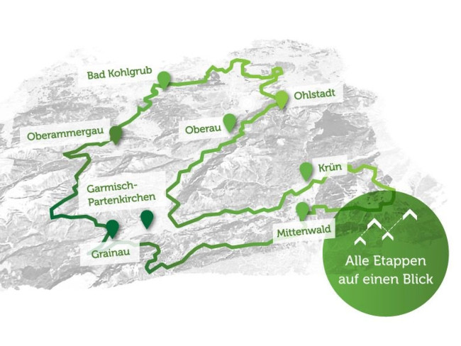
Picture © spitzenwanderweg.de
To stage 3: Through the Partnach Gorge from Garmisch-Partenkirchen to Krün
Stage 6: From Mittenwald to Schachenhaus
“The mountain is calling! ”
Luis Trenker, Italian mountaineer and actor, 1892 — 1990
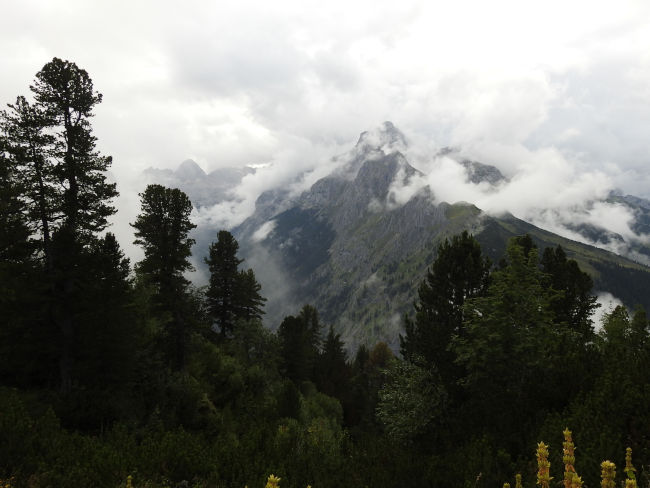
Today we have a two-day stage ahead of us, which will take us from Mittenwald to Schachenhaus and from there the next day to Kreuzeck and thus back to Garmisch-Partenkirchen and Grainau. I respect this stage, not only are there 1,215 meters of altitude difference to be tackled, but the next day a huge descent awaits us, which leads down into the valley from above on a narrow alpine hiking trail. Accordingly, sure-footedness is required and hikers should not be afraid of heights. I am all the happier that I am hiking these stages again with my colleague Polly, because as a prospective mountain ranger, I feel in good hands with her.
Unfortunately, the weather is supposed to be variable over the next two days, but it looks like the morning after that we will be spared from rain until late afternoon and will therefore reach the chess house with dry feet. Accordingly, we start early in Mittenwald to safely escape the rain showers. The backpack is well packed with a change of clothes in case we get wet, warm sweaters (at night the temperatures can drop quite a bit even in summer) and rain jacket, as well as enough water and food for between meals and, of course, what we still need for the night in the chess house.
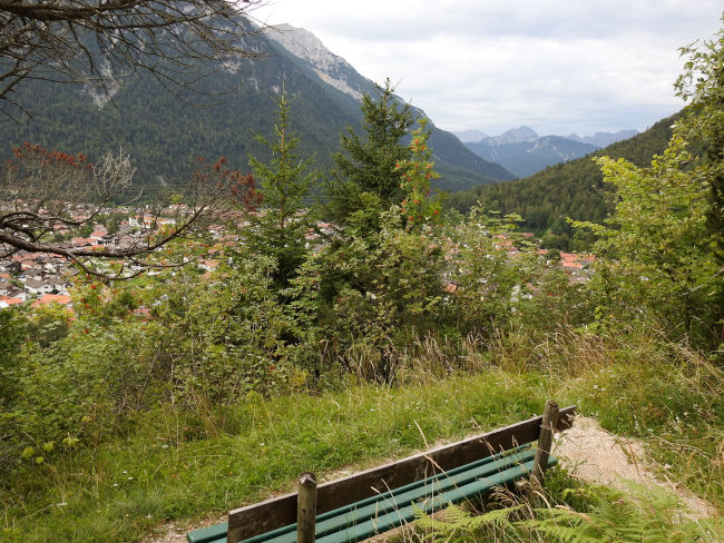
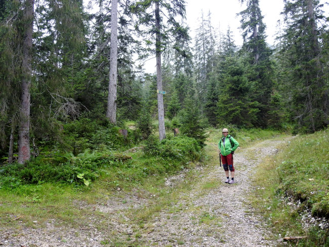
It's uphill from Mittenwald for now. An initial route detour ensures that we are allowed to climb the first few meters in altitude via stairs. The leg muscles are immediately happy about this. Then we zigzag along a nature trail up to the altitude until we reach the geological trail. The first part of the trail to Ferchensee is well known to me and therefore I know that the first kilometers of the trail will be at least a walk. After the first climb, the trail continues on almost flat paths to Lautersee.
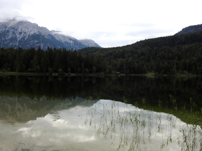
Lake Lautersee is quickly reached and is still very quiet there. Apart from us, there are only two cyclists on the road so far. However, the weather is not really inviting today, especially not for swimming enthusiasts who frequent the local outdoor pool when the weather is nice. On the other hand, we've had really hot temperatures over the last few days and today we'd rather climb 1,215 meters in altitude at 15°C than over 25°C. In return, there is also a short jump in Ferchensee to cool off today.
From Lautersee, it's a bit uphill again and then we'll soon reach Ferchensee. We made very good progress on the first part of the trail. From Ferchensee, it is now time to pay attention to hiking signs, because from here we have no idea how the top hiking trail will continue. I still remember that there was a turnoff that leads up a small trail, but I don't know whether it was the top hiking trail, as I had not seen any sign back then either.

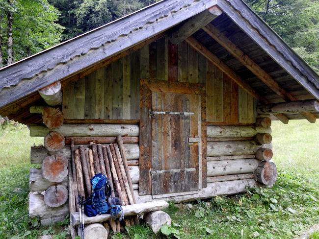
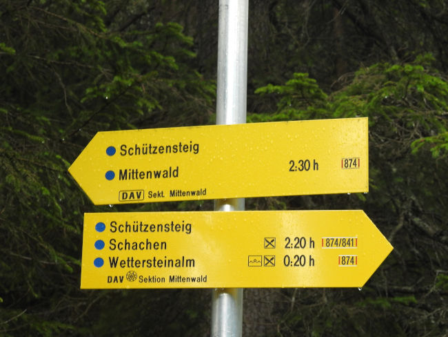
The sign of the Spitzenwanderweg is actually somewhat hidden between the trees and bushes, but points to the trail that I remembered. From here, it's time to march uphill again. We continue on a thin path for a few hundred meters until we reach a wooden hut with a small bench in front of it. Here we take a first break, have a drink and eat a first sandwich.
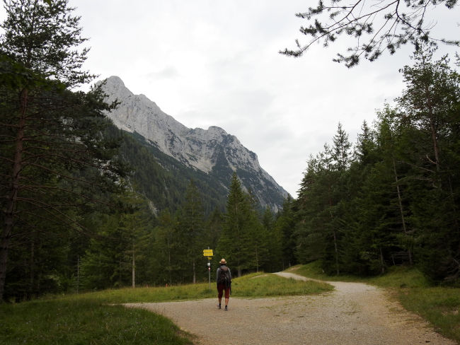
Before we continue, let's take a look at the weather app again. It still looks like it's just cloudy at wetter.de, Polly on weather.com is already expecting rain. Let's see which weather forecast will be correct. I hope mine. From the hut, the first really steep climb starts, which leads us onto the Schützensteig. Polly is already up faster than I am, but I too can get to the top. Once at the height, a sign tells us that it is still 3:50 hours until Schachen. Down at Ferchensee, it was still 04:30 hours. However, it is now raining and so we put on our rain clothes. However, the Schützensteig leads beautifully through a wooded landscape so that the trees protect us from rain and we don't get too wet.

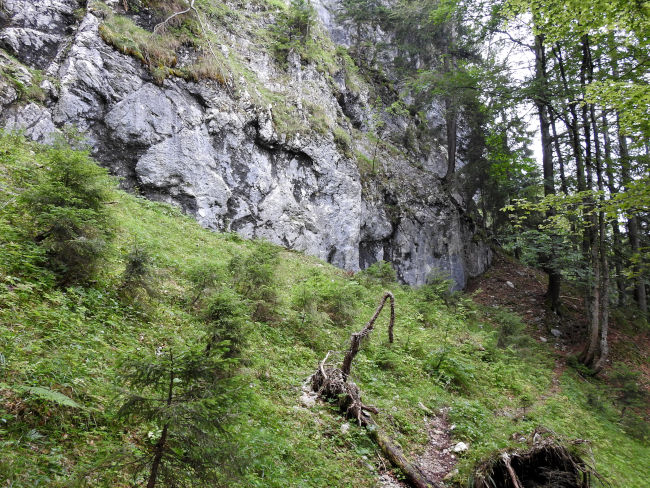
The narrow path leads through a truly fantastic landscape. Sometimes straight up, sometimes uphill, we pass primeval passages, sometimes we run past metre-high rocks that rise to the left of the path. If it wasn't for the rain, we would certainly enjoy this passage even more, but our pants legs are on the wet grass and the bushes through which the narrow path runs, so that we can slowly feel the moisture.
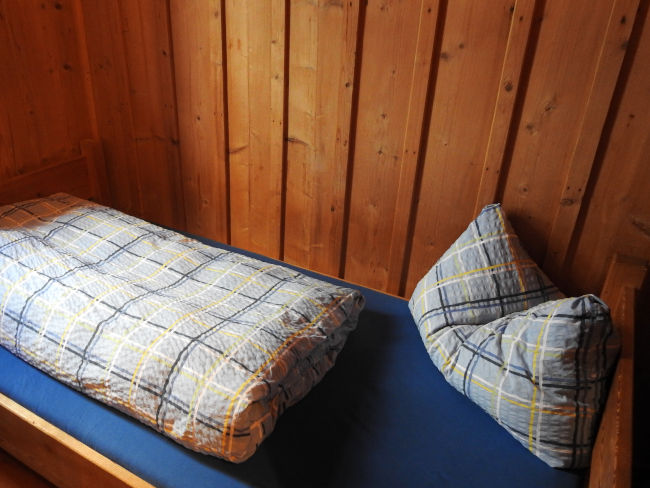
We now have the feeling that we have been on the path forever. Since the first track seemed quite short to us, we almost believe that we will soon have to reach the end of the Schützensteig. We need a short break first, even if it continues to rain over us. A tree trunk is enough for us to sit on this time and with the packed cushions we can sit dry. The foliage of the trees above us protects us. With the hiking app, we are trying to identify our current location, but unfortunately the reception up here is not outstanding. We haven't seen a sign for a long time. After 10 minutes, it gets too uncomfortable for us and continues. It can't be far to the Wettersteinalm anymore.
We continue to walk through dense forest and follow the only available path. That's when we hear the first cowbells from afar. That is a good sign. Where there are cows, the alpine hut cannot be far away. In fact, we reach a clearing soon after and we reach a wider path. There is finally a hiking sign here that only shows 20 minutes to the Wettersteinalm. Thank goodness I'm just saying — the long-awaited stop for this hike is now almost within sight. 20 minutes, that's a piece of cake. There is new energy, the tiredness is gone, the legs feel light again and the walking speed increases.
The cowbells ring harder and harder at first, things are going well, but then the initially wide path becomes small and narrow again. It goes through the forest again, the ringing of the bells is getting more and more and there is silence in the forest. We have already walked for 20 minutes and then we are also faced with a steep descent. Are we even on the right track? We feel like we've been fooled in a way. But there were no other junctions. So let's keep following the path. After another eternity that happened to us, which has completely expelled the initial energy in the clearing, we finally see the alpine hut. What a blessing. A few more meters and we're at the door. We can hang up our wet things in the stable and then enter the hut.

I can bury the desire for a schnitzel with fries and salad. The menu includes two soups, Kaiserschmarrn and various cake variants. Let's first treat ourselves to noodle soup to warm ourselves up. The fireplace is lit, a group near the fireplace leaves the hut so that we can move up quickly and sit closer to the warming fire. The soup has warmed up well before, but we need a bit more in our stomachs for the rest of the climb. So another Kaiserschmarrn.

Rested, slightly dried and strengthened, we leave the Wettersteinalm to take the last stretch up to the chess house. Normally, we would make the ascent to Schachen via Schachentorsteig. However, the weather is thwarting our plans. The ridge is covered in clouds, it is still raining, albeit light, and it would currently be too dangerous to walk this trail if it could be avoided. The landlords also advise against this in weather conditions. So we follow the normal hiking signs up to Schachen. On a wide hiking trail, it's now long uphill bends.
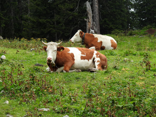
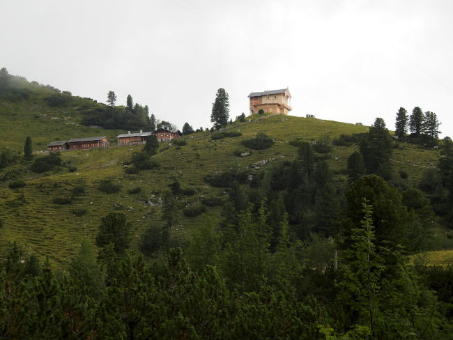
Where we were still among ourselves on the Schützensteig, we increasingly meet some hikers and even mountain bikers coming from Elmau to the Schachen. We also meet some cows who have made themselves comfortable in the wet grass. The rain stops again, but the cloud cover in the mountains is still thick, so that the beautiful mountain views that we would actually have from this altitude remain hidden from us. It's a shame. After further curves, we see the royal house on Schachen, although still in the distance, but at least our final destination is already in sight. Polly, who has already hiked the Schachenhaus several times this way, suggests a short trip to Schachensee, which she absolutely wants to show me.
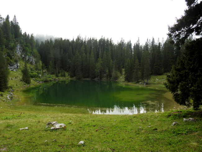
The turquoise-blue Schachensee would certainly have been worth a break if the weather was nice and we would have jumped into the lake without further ado, but now we're looking at it from afar, taking a photo and heading back to the main trail to finally reach our final destination of today's stage. King Ludwig's hunting lodge and chess house reappear before our eyes. It's not far off, then we've done it.
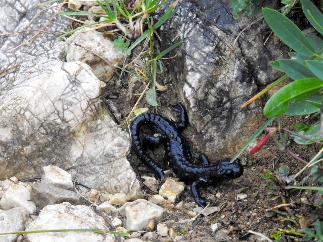
With strong steps to have almost reached the end of today's hiking day, a warm room, dry clothes and a hopefully good dinner in front of your eyes, motivates and gives you energy again. Unfortunately, the rain starts even more heavily, but that's not so bad anymore. Polly's weather forecast was therefore more accurate than mine. We'll be there soon. In the last few meters, we walk through a blooming landscape, peppered with yellow gentian, which unfortunately has already faded away a bit. But there is still an animal highlight. A small alpine salamander is currently seeking shelter between the rocks.
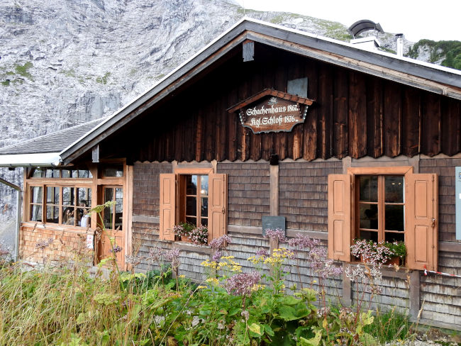
We've done it. We are at the door of the Schachenhaus and now we just want to get our key to our double room. The chess house also has a drying room where we hang our wet clothes to dry after we have changed quickly. The socks are completely soaked and so are the shoes, but everything will be dry again by tomorrow. Dinner is served quickly. The evening menu is also very manageable. I opt for a couple of wieners with potato salad, Polly for the spaghetti bolognese.
After dinner, the weather clears up a bit, so it's worth taking another short tour around the Königshaus am Schachen. The castle built by King Ludwig II of Bavaria between 1869 and 1872 according to plans by Georg Dollmann was built in Swiss chalet style. It is often referred to as a hunting lodge, but King Ludwig II thought nothing of the hunt. Rather inconspicuous from the outside compared to the king's other palace buildings, the interior is however magnificently furnished, in particular the Turkish Room, which the king had designed based on a palace in Eyüp near Istanbul.
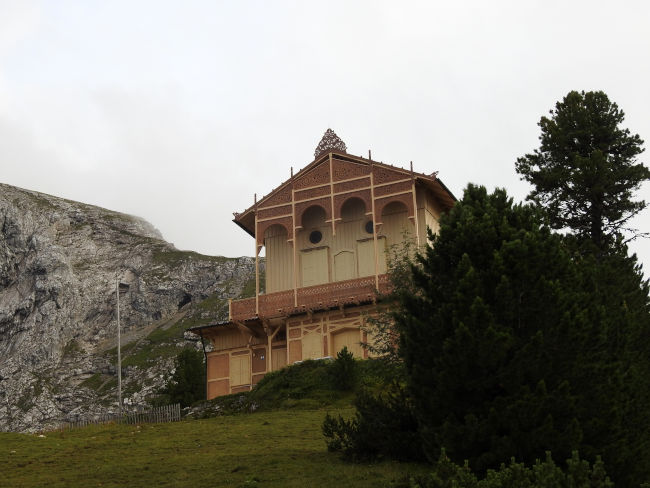
Unfortunately, the premises are already closed, so we will probably have to come back here again to take a guided tour of the Royal Castle. But since we were also unable to climb the Schachentorsteig trail, there is one more reason to return here again. The alpine garden is also already closed, so we're just taking a short round. Our trail tomorrow is usually easy to see from up here, but now there are clouds everywhere in the mountains.
Let's hope the weather improves by tomorrow. Should it get worse, it would probably be advisable to descend back to Mittenwald, because if it rained, the descent into Reintal would be quite dangerous and very slippery. However, we are in a positive mood. I'm also excited to see how my muscles will feel tomorrow morning. I sincerely hope that I won't feel any sore muscles. It's time for a good night's sleep and we'll see more tomorrow morning. Overall, it was a good hiking day despite the rain.
Tips & info:
- Route length: 15 km, performance kilometers: 26 km
- Walking time without a break: approx. 5 hours 9 minutes (this is really only for very fast and experienced hikers, you should calculate approx. 6 hours 15 minutes to 7 hours 30 minutes without a break)
- Altitude approx. 1,215 m high, 549 m down, highest point 1,878 m
- Difficult hike, mostly mountainous terrain, mostly on narrow, small trails, good hiking boots required and hiking sticks.
- Unfortunately, the tourist office only provides an overview map of the Spitzenwanderweg. There is also no digital trail map on the official Spitzenwanderweg website. The best navigation is here.
- Public transport: Eibsee bus from Hotel am Badersee to Garmisch-Partenkirchen train station, then take the regional train 5411 to Mittenwald train station (approx. 1:11 journey time). If you travel to Mittenwald by car, you can park your car in the city center (preferably free parking or underground parking, with no parking time limit).
- Places to stop for refreshments: Lautersee Alm (opens at 10:00), Seehof Lautersee (opens from 09:00), Gasthaus Ferchensee (opens at 09:00) Wettersteinalm (only open from the end of June to the beginning of September!) Check current opening times in advance.
- The tour can be abbreviated in part. You can drive up to Ferchensee and climb from there (approx. 1:45 hours less hiking time).
- Most of the hiking signs of the Spitzenwanderweg are there. In bad weather, it is better to use the wide hiking trail to Schachen from Wettersteinalm than to walk across the Schachentorsteig. Safety comes first.
- Overnight at Schachenhaus and tour of Könighaus: www.schachenhaus.de
- If you are more fit, you can climb up to the Meilerhütte (approx. +500 hm). At 2,372 m above sea level, the Meilerhütte is Germany's second-highest hut. Read our blog on top of that.
Heartily Wellcome
at Lake Badersee