Excursion tip: Karwendel Railway & Mittenwald Mountain Trail — part 2

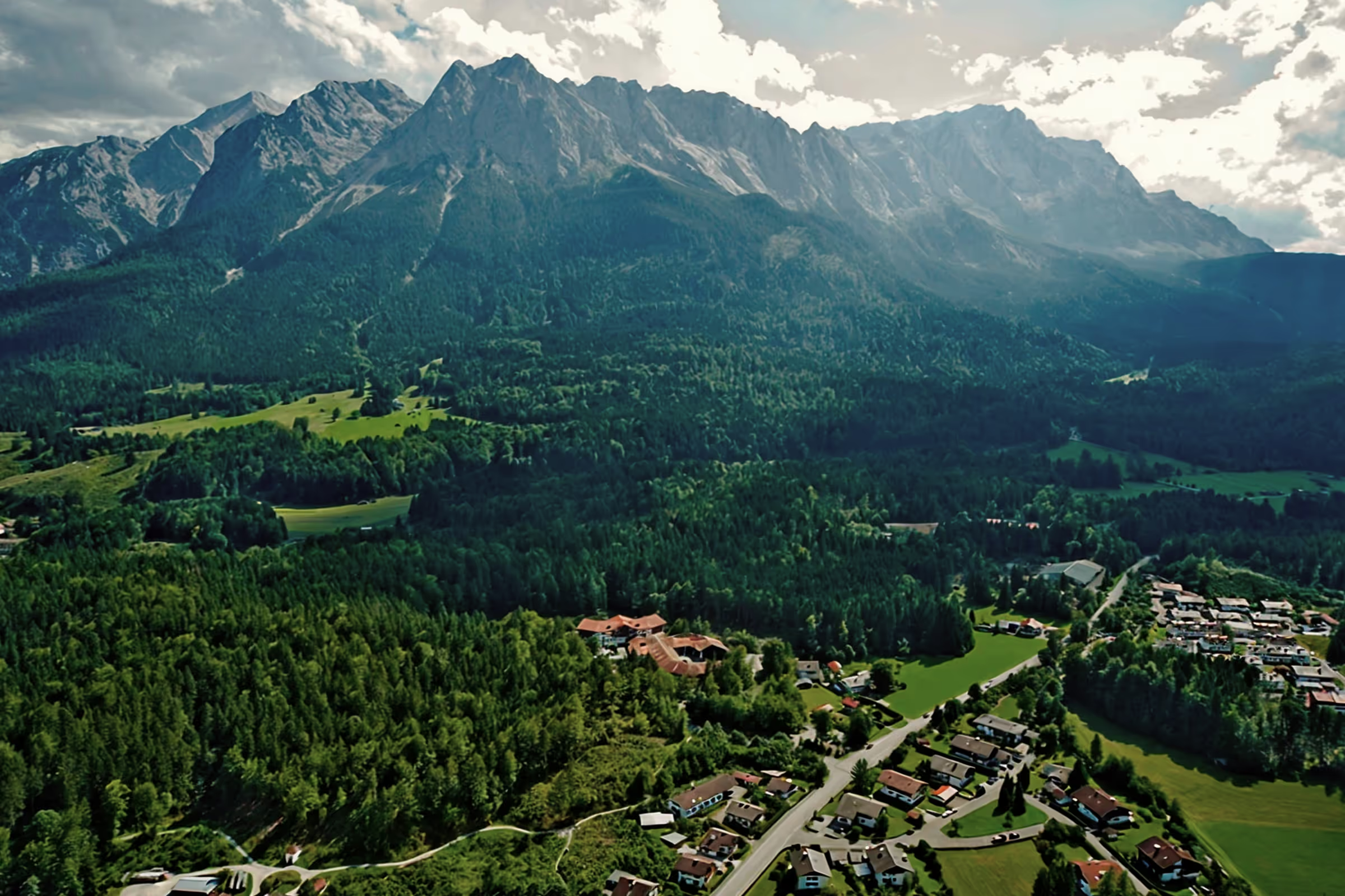
The Karwendel Mountains in Mittenwald are among the highest and at the same time the most beautiful mountain ranges on the border between Bavaria and Tyrol. For experienced mountaineers, the mountain range offers numerous challenging routes with many meters of altitude and nice places to stop for refreshments, in particular the famous Mittenwald mountain trail.
Tour profile
Difficulty level: difficult
Route length: approx. 20 km (total)
ascents: 1,800 hm
descents: 1,800 hm
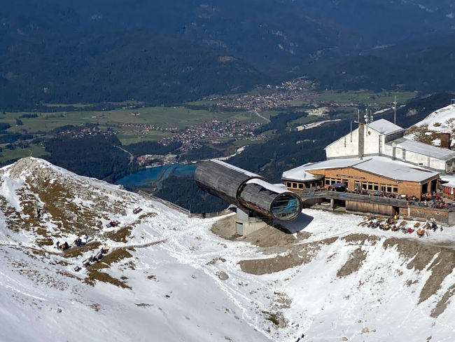
The Karwendel also offers a great opportunity to easily reach high alpine destinations - through the connection with the Karwendel Railway. This makes the so-called Karwendel Grube, where the mountain station is located below the Western Karwendelspitze, a popular excursion and hiking destination. Here at an altitude of 2,244 m, day trippers will find easy hiking routes with breathtaking panoramic views. The summit cross on the Westliche Karwendelspitze can be reached from the mountain station in just 20 minutes and is perfect for great summit photos. The local mountain restaurant serves the in-house beer type “2244”.
Part 1: Our trip with the Karwendel cable car
Part 2: Mittenwalder Höhenweg
Two weeks after our trip with the Karwendel cable car, my dream comes true and a colleague from the mountain rescue team agrees to join me to cross the Mittenwald mountain trail. Of course, we want to do the tour without mountain railway support, which for me means that it will be a very sporty undertaking with over 1,900 m above sea level - I've never done this much in one day before. So I'm really excited to see how I'm doing - not that I have to be saved by my comrades.
In view of the rainy weather, a lot of snow is to be expected at the top, which means that our upcoming tour in mid-October is likely to open the winter season. Accordingly, we pack the groedel or crampons and warm clothing. However, my buddy thinks that the via ferrata usually runs across the south side, which in combination with the summit wind sometimes causes the snow to be blown off quickly or to melt into the sun.
The climb
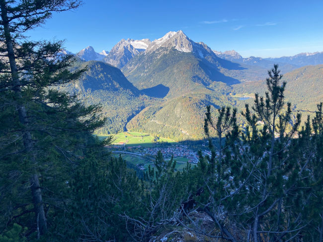
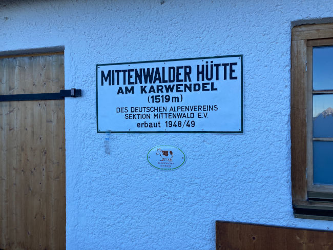
09:00 o'clock: Once in Mittenwald, we park the car at the Karwendel cable car valley station (933 m above sea level) and cross the B2 over a sunset to reach the starting point of our hike. Another friend of ours is coming later on the Karwendel cable car, the meeting point is arranged above at 12 o'clock. First we take the trail to the Mittenwalder Hütte (1,519 m), which we reach after just one hour for sports.
10:00 o'clock: From here, according to signs, it's 3:15 hours to the Westliche Karwendelspitze, i.e. just above the mountain station. The trail, which usually leads through exposed rocks and karlands, is closed in winter depending on snow conditions and the risk of avalanches. Let's see how long it takes us today - our girlfriend should be upstairs for lunch. The first snowfields are now coming directly from the hut and the trail is partially icy. However, we get along well with our hiking poles, Grödel/crampons are not yet necessary. Steeper sections are fitted with wire, which is still easily accessible everywhere in today's snow conditions. The higher we climb, the deeper the snow gets. The ice no longer bothers us: the ascent to the mountain station is completely in shade, the sun barely gets into the gutter even during the day, so the powder snow is kept soft for a very long time and there is hardly any icing.
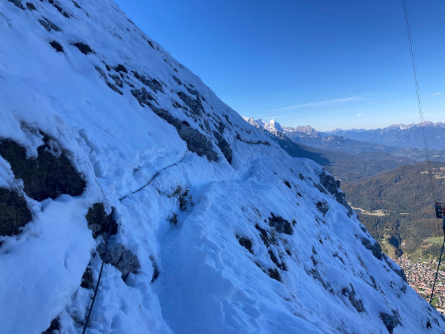
11:00 o'clock: Shortly after 11 o'clock, we reach one of the two cable car posts. During a drinking break, we watch the two gondolas say hello to each other at lofty heights. From here, the trail gets even steeper and the snow significantly deeper. If things continue like this, I won't have the strength left for the via ferrata, such a sad thought goes through my head. But the feet and legs know no grief and bravely leave the path buried in the snow with its difficulties behind them step by step. Just before noon, we stand below the mountain station and watch the next gondola that our girlfriend may have brought.
12:00 o'clock: The girlfriend has actually arrived now, she is trying to reach us by phone and is looking for us on the upper plateau. We have finally done it and will soon be just above the mountain station. As soon as we manage to get our feet on a level, my body goes on strike after a lunch break. Soon the three of us will be sitting on a bench and eating apples. My comrade suggests starting the mountain trail as it should be at the Westliche Karwendelspitze. But it is more important for me right now to take a breather before the multi-hour via ferrata, especially if I had already visited the summit a few weeks ago. So the two of them with the backpacks leave me lying on a bench at the bottom of the ridge for a little nap.
The mountain trail
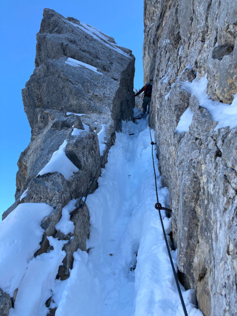
1:45 p.m.: After an extended break (which I've definitely earned after 1,300 m), I'm off on the Mittenwald High Trail. After the turnoff to Heinrich-Nö-Weg, we reach the starting point of our tour. A completely different picture awaits me above than two weeks ago: the trail is completely blown away with snow. We put on our grödel and crampons accordingly. But the good thing about it is that the trail has been groomed and in deep snow, you can even see how to get through the safest way after individual steps. Once set up for a hike, we dismantle our hiking sticks. We will secure ourselves on a tightrope for the upcoming climbing route.
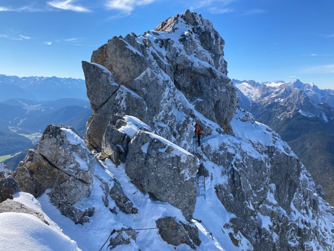
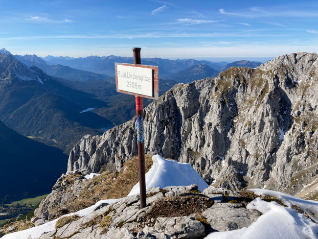
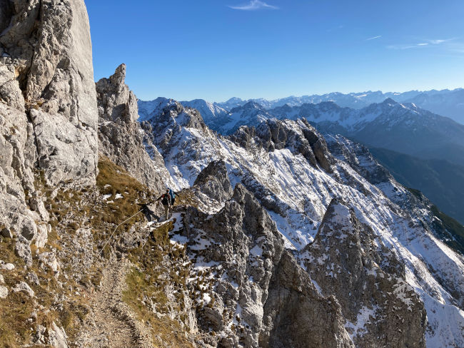
2:30 p.m.: It progresses quickly and we leave the three Linder peaks (2,372 m, 2,239 m and 2,304 m) behind us. Then it's off to the intersection with the Heinrich-Nö-Weg, which you can use as an alternative route. The next section starts with an approx. 50 m high vertical metal ladder. We have to be careful here because of the slipperiness, although there is no ice directly on it. The heavily exposed rope-protected route takes us through bare rocks, partly over iron bars or wooden bridges. The view in every direction is breathtaking, so we get into raptures and spontaneously take a break at one of the border markings - our route runs directly across the German-Austrian border. We are about to be visited by two alpine jackdaws, which land next to us and look for possible delicacies. Your efforts will be rewarded with a few almonds.
3:40 p.m.: Then it goes down again and we reach a flat spot between two mountain ranges, where there are no hiking signs. At the front, a trail goes into the shadows, where there is a sign “risk of falling rocks” on the side of the road. In deep snow, the slope is therefore also potentially hazardous to avalanches, so we are looking for possible alternatives. Even though there is a turnoff here, the tracks are blown away with snow. We have no choice but to continue following the trail, but that is also consistent with our route description. The path here leads steeply upwards over a 1 m wide stone crevice with metal steps, which we have to climb with a lot of effort. Surprisingly, climbing is even better with snow than without it. But the altitude difference is already noticeable, we are slowly getting tired and the question that really interests us right now is: Do you have to climb back to the summit? The answer remains unclear until we notice a human figure with a yellow jacket on the slope just approaching the summit.
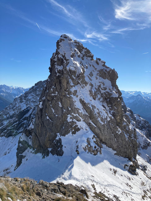
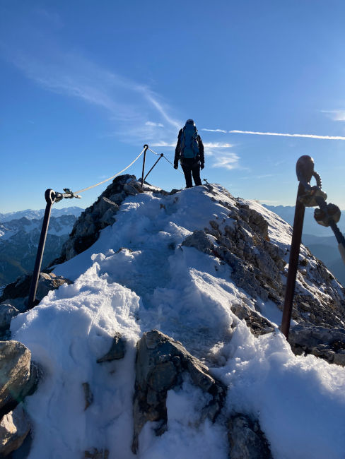
4:15 p.m.: In the next quarter of an hour, we'll fight our way through the snowy slope. Just before we reach the summit of Sulzleklammspitze (2,323 m), the sun throws its warm rays on us again. Here, the slope is also free of snow. We want to believe that it was the last summit - the announced 500 m would feel like it would be long gone, it should be a pleasant tightrope walk at some point, right? The yellow figure, which serves as a guide for us, is now disappearing behind the ridge, and we are already looking forward to a relaxed descent. There are more peaks ahead, but our buddy (and spontaneously also group leader, as someone who knows the route) thinks the trail should be below the peaks.
4:30 p.m.: After a short break at the summit, where we eat our remaining apples and pears under the evening sun, we pack up our hiking sticks again.
- Ooooh no! - Our girlfriend suddenly calls and points to the next summit. Our “yellow” is up there. So it's going up again! What a disappointment. We're already really tired. The sun tilts significantly westwards and we still have a significant part of our route ahead of us. According to the route description, the descent to Brunnsteinhütte alone should run over rugged rocks and therefore be extremely difficult. Well, we don't have a choice, and with our last strength and hiking sticks, we climb the next two (fortunately smaller) peaks. In the end, a glimpse of an anger opens up before us, which is followed by another climb. Whether the next mountain is also on our route?
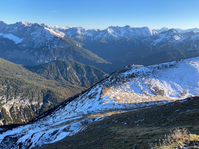
5:30 p.m.: After we reach the Anger, we discover the nearest hiking signs there. From here, it's finally down to the valley - for now 700 m to the Brunnsteinhütte. After the entire altitude difference that we have covered today, our legs run down almost by machine. It is impressive how our brain helps the body learn new complex movements. At the beginning of my mountain activity, the descent was always a challenge for me, but now after tens of thousands of meters of altitude difference, I don't even have to turn my head on during the descent, except for a few places where you have to climb down - otherwise my feet will be able to find the way by themselves. I don't even notice that there's no more snow lying around. In long loops, the trail snakes through the slope covered with mountain pine and mountain ash. Many reports on the Internet describe this section as extremely demanding, but it seemed like a normal hiking trail to us.
6:30 p.m.: With the last rays of sunshine, we reach the Brunnsteinhütte (1,523 m). Since 1965, the hut has been owned by the Mittenwald Alpine Club section, it was completely rebuilt in 1981 and has been the target for innovative pilot projects time and again since then. Thanks to continuous efforts to sustainably improve supply, the Brunnsteinhütte is now managed autonomously and in an environmentally friendly manner. Among other things, the smelter has been supplied by a new water pipe from the Sulzleklamm gorge since 2013, with electricity being generated locally by a 1kW turbine.
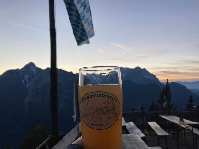
The Brunnsteinhütte is open today for the last time this year. We still manage to toast with wheat beer and apple spritzer on the terrace at sunset. Then it's on with headlamps through the dark forest. After about 40 minutes of descent, we take the trail across the suspension bridge at the junction to get back to our starting point on the Karwendel cable car. We won't be standing by our cars until around 9 p.m.
conclusion: It is an incredible tour for experienced mountaineers that requires a lot of fitness and high alpine experience. The entire route, including (long) breaks, took us almost 12 hours, including 3 hours for the ascent (1,350 m) and over 4 hours for the via ferrata/tightrope walk (approx. 600 m). Total length: approx. 21 km. For the via ferrata, you should plan more time for possible breaks. In winter, the trail is barely accessible, and many sections are also dangerous for avalanches. The route is highly recommended for the summer season, but you have to watch the weather very closely (thunderstorm). In summer, the via ferrata is also very popular. You can save yourself some of the altitude difference by taking the Karwendel cable car to the top. Hiking the route from back to front (from Brunnsteinhütte to Karwendel cable car mountain station) also seems like a good idea. In autumn, you have to expect snow at higher altitudes. Because of the short days, it is recommended to bring a headlamp.
Tips & info:
- Karwendel Railway: Information & opening times. Parking fees must be paid.
- Getting there: From Hotel am Badersee, you can reach Mittenwald by car via the B2, the exit to the Karwendel cable car is specially marked. By public transport, you can reach Garmisch-Partenkirchen train station first with the Zugspitzbahn or the Eibsee bus, then by regional train to Mittenwald. From Mittenwald train station, it takes about 10-15 minutes on foot to the Karwendel cable car valley station.
- Alternatively, the ascent is via the less steep Dammkar-Route possible. On the go, you can go to the Dammkarhütte (1,650 m) stop off. Finally, you cross the Westliche Karwendelspitze through a massive tunnel, which is itself an attraction, and come out again at the mountain station.
- Mittenwalder Hut: Information & opening times
- Brunnsteinhütte: Information & opening times
Heartily Wellcome
at Lake Badersee