Top hiking trail stage 11: From Unterammergau to Bad Kohlgrub

The eleventh stage of the peak hiking trail runs from Unterammergau to Bad Kohlgrub. Once again, a summit is crossed, the Hörnle. On this stage, you have the chance to climb even three peaks, as the Hörnle forms a small group of three peaks called Vorderes Hörnle (1,484 m), Mittleres Hörnle (1,496 m) and Hinteres Hörnle (1,548 m). The Hörnle is a popular peak that is often frequented by locals. At the summit, there is a beautiful mountain inn that invites you to stop off. Once you reach the summit, it's all downhill from there to the destination of Bad Kohlgrub.
Tour profile
Difficulty level: easy to medium
Route length: approx. 15 km (total)
ascents: 500 hm
descents: 500 hm

Map © www.ich-geh-wandern.de
Top hiking trail — experience the natural landscape of the Zugspitze region over 200 km
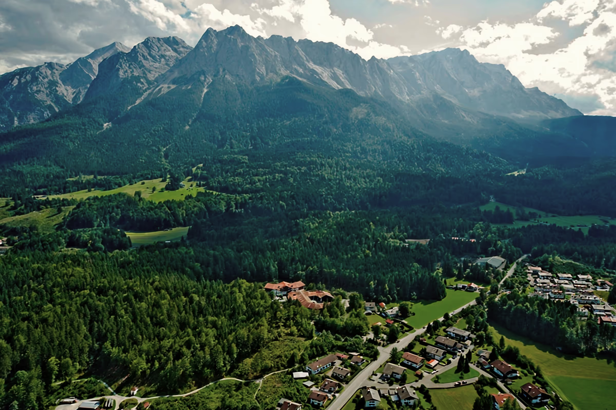
Not too long ago, the Spitzenwanderweg was ceremonially opened. The long-distance hiking trail covers 200 km and 12 stages through the picturesquely diverse landscape of the Zugspitze region. More than 6,800 meters of altitude difference are also covered, so the top hiking trail is quite a sporting endeavor. But it's worth it. Because the trail leads through a diverse landscape and also passes through numerous cultural monuments. The start and end point is the picturesque town of Murnau. Two overnight stays in huts are included on the long-distance hiking trail, once in the Soiern House and once in the Schachenhaus. On the 200 km, hikers pass fantastic views, flower-rich mountain and moor meadows, deep blue mountain lakes, bubbling springs and rivers, the spectacular Partnach and Höllental gorge, foothills of the Alps with far-reaching views, as well as cultural monuments such as the royal castles of Schachen and Linderhof Castle, as well as typical Bavarian villages such as Murnau, Krün, Mittenwald, Grainau or Oberammergau. There is therefore much to experience and discover on the 200 km long trail.
And we too are keen on the long-distance hiking trail and are treading this stage by stage, because the trail will also be a special experience for us locals. I will walk the path partly alone, but also with my colleague. Join us on the hiking trail.
The top hiking trail: All stages at a glance
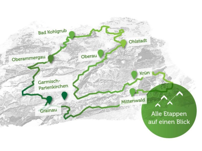
Picture © spitzenwanderweg.de
On stage 10: From Linderhof Castle to Unterammergau
Stage 11: From Unterammergau to Bad Kohlgrub
“I want to climb the mountains. ”
Heinrich Heine, German poet and writer, 1797 - 1856
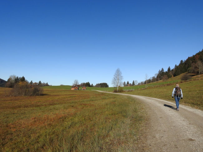
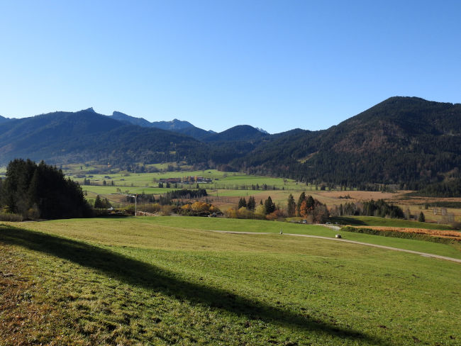
It is a wonderful November morning when I set off together with Polly to hike the 11th stage of the peak hiking trail. We park the car at around 10:30 in Unterammergau at a free parking lot near the restaurant. The first fresh morning cold that November brings in the mountainous region and the cool fog in the valley have already disappeared. The temperatures have risen slightly and the mountains are illuminated by the sun. We briefly consider whether we should leave the jacket in the car, but decide to better pack it in our backpack, who knows whether there will be a wind at the summit and the warm looking rays of the sun will then no longer give off any heat.
We walk up to the main road, cross it and follow the hiking sign of the peak hiking trail out of Bad Kohlgrub towards the chapel church, whose church tower can already be seen in the distance. A short time later, we also reached the chapel church. The pilgrimage church is officially called Holy Blood. There is also a hiking car park here, which is always very full. Most hikers who hike from Unterammergau to the Hörnle park here. On this beautiful November day and at 11:00 a.m., the hiking car park is also already full and many hiking couples and families are out and about. We follow the other hikers first, then we are happy when our hiking sign branches off to the left and we thus separate ourselves from all other day trippers.

The trail runs a short distance through a forest, crosses a stream and then gradually climbs up a wider forest road. Apart from a few farmers, we don't meet any other people here. What a difference a branch can make. At first, it seems as though the trail is taking us away from the Hörnle again, because from our point of view, the summit is now right behind us. But the hiking trail soon draws its bow and then we head back towards the mountain.
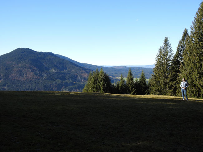
The autumn sun is fantastically beautiful, the weather so clear that we can enjoy extreme views today, the trees are still dressed in autumn, no strong winds have yet caused the deciduous trees to look naked in winter. We pass a few goats that are currently bathing in the sun and continue to climb uphill continuously. We enjoy the view of the Pürschling, which opens up to the other side and whose summit I climbed not too long ago. Many hikers will certainly make their way to this summit again today.
We climb higher and higher, and now we also meet a few other walkers who are out and about with their dogs and come to meet us. Were they already at the top of the summit? Halfway up, we take a first break, sit down on the grass and enjoy the sun shining down on us. There is no longer any sign of November temperatures in the sun. The fleece jacket is no longer on the body for a long time, the climb has once again ensured that the circulation got going and that any feeling of cold still present in the morning has escaped from the body. I've packed a cold and a hot drink, I'm currently in the mood for the cold drink. We eat our first break meal, enjoy the sun on our bodies and the view for a moment, then we pack it again.
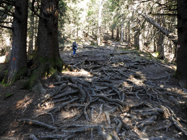
After the meadow, the hiking trail changes. It goes into a shady wooded area, the wide hiking trail becomes a narrow forest trail covered by the roots of the trees. Mindfulness is required here, as the roots form excellent pitfalls. It's also getting steeper. After the pulse had just recovered, it is now fully up and running again. We also have to climb over a few fallen trees and let a few hikers pass through as they approach us. At the top of the hill, we meet an elderly hiking couple with whom we start talking. The lady is 78 years old and they are also on their way to the summit. Wow, how admirable. When it comes to the older woman's fitness, I immediately feel ancient as Asbach.
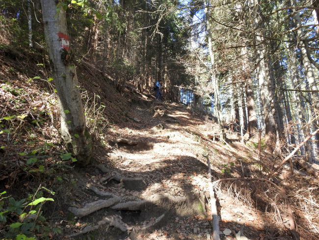
After we have also overcome the initial rise in roots, we reach a first plateau, from which we can look to the other side towards Bad Kohlgrub. The view is over the flat, blue countryside. We've reached the border of the mountains. It is now a bit further flat and the summit of the Hörnle is now not far away. A hiking sign shows 15 minutes to the summit, but across a wider forest road. Polly, however, says that we should take the path straight ahead, which is shorter. What she didn't tell me, however, is that the abbreviation is also much steeper and again includes a root obstacle course. While she is already a few meters ahead of me, I almost regret that I didn't just stick to the signposted path.
Thank goodness every climb comes to an end and if you only ever take one step at a time, you'll eventually reach the top as well. Below the Hörnlehütte, we come back on the main trail, which is followed by many other hikers. Polly waves at me from the meadow at the hut. She has already reserved a spot in the sun for us, which I will now also gratefully sit down. The summit has been climbed once again. Now it's time to soak up the sun, drink, eat and enjoy the view. However, while our last break was crowned with birdsong and the sounds of the forest, the loud noise level of humanity now surrounds us at the summit.
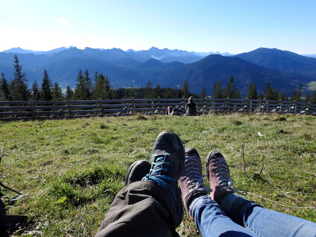
The sun is so warm, we could have left our jacket in the car, there is no cool wind and the view is so beautiful that we could have spent a few hours up here. However, in autumn, the sun disappears quickly behind the peaks, it becomes shadier and therefore cooler. Until that happens, we definitely want to be down in Bad Kohlgrub. After we have treated ourselves to a good hour of summit luck, we clear our place again and we continue. Bad Kohlgrub is easily visible from the summit, as is the final stage destination Murnau. What you can also easily see from the summit is that the last stage is flat. No more peaks to cross. On the one hand, it's nice, but on the other hand, it's also a shame. The final destination of the peak hiking trail is within reach.
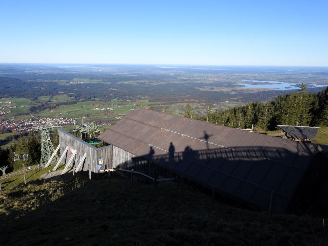
It's all downhill from Hörnle now. According to the hiking sign, it takes 1 ¼ hours to reach the village. Paragliders sail above us, taking the air down into the valley. That would certainly have been a great opportunity too. However, as the Hörnlebahn is currently closed, I wonder if the paragliders went all the way up to the summit with a paraglider in luggage. Certainly only something for the very sporty ones. As we walk downhill, we are still met by many hikers who are still on their way to the summit. In spring, I also walked up and down this trail with a friend, making it familiar territory. However, we were on the road early and it wasn't as busy as it is now at this time. The weather was also worse back then and the views were not as great as they are today.

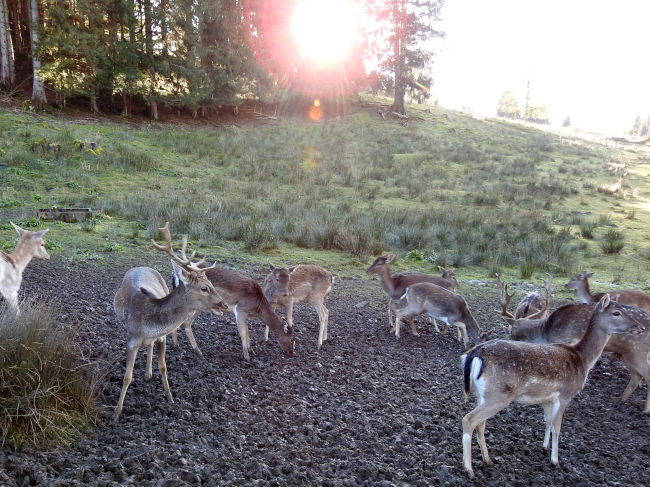
Shortly before the end of the descent, I was already wondering whether we would see fallow deer grazing behind a fenced area again. Today, the flock of fallow deer is lucky because a few children stand at the fence and feed the wild animals. Of course, we didn't have anything with us back then and so the animals didn't come close to us. So we'll stop for a while with the beautiful animals.
We finish the descent via Sonneneck and follow the hiking sign to the Reindl ski slope and the Hörnlebahn valley station. The parking lot is also well occupied here, even though the first cars are leaving in the afternoon after a perfect day in the mountains. It then becomes quiet again behind the parking lot, we separate ourselves from the other day trippers and are once again among ourselves.
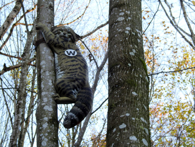
Before we enter Bad Kohlgrub, we head into the Ludwigschlucht, a gorge forest biotope that is also good for children to walk on, as there are information boards along the way. Over various bridges, it goes right and left through the gorge. We are a bit frightened when we spot an animal at the top of the tree. We just have to look twice, because we didn't expect that now. A wild cat is actually clinging to the tree trunk! Well, unfortunately it is not a real one. It's a shame.
We get out of the gorge again and reach the town of Bad Kohlgrub at the Kurpark. As expected, the sun disappeared behind the mountains in the afternoon and it cooled down noticeably. We are all the more looking forward to a hot drink after the hike and a nicely warmed room at home. It was great again!
Tips & info:
- Route length: 11 km, performance kilometers: 15 km
- Walking time without a break: 3 hours 3 minutes
- Altitude approx. 450 m high, 458 m down, highest point 1,390 m
- Moderately difficult hike, mostly mountainous terrain, mostly field and forest trails, partly root trails. Good hiking boots and hiking sticks required.
- Unfortunately, the tourist office only provides an overview map of the Spitzenwanderweg. There is also no digital trail map on the official Spitzenwanderweg website. The best navigation is here.
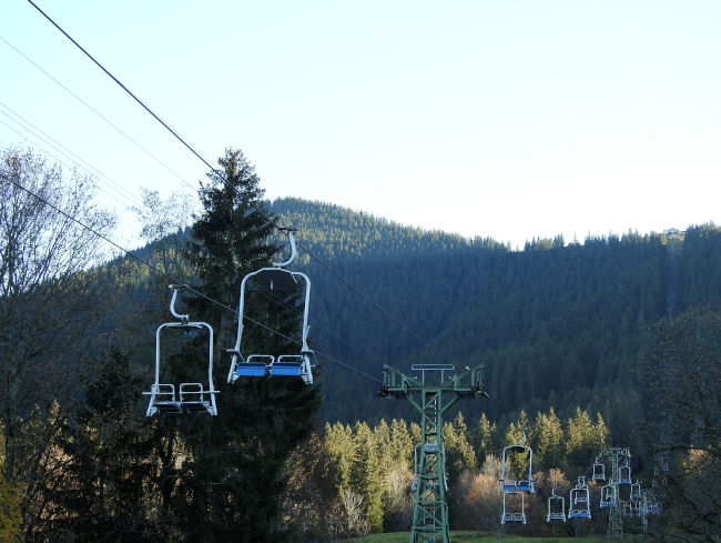
- It is possible to abbreviate or simplify the hike by using the Hörnleseilbahn descends from the summit. The railway operates in summer and winter. Please note opening times.
- Arrival by car: From Hotel am Badersee via Garmisch-Partenkirchen to Oberau, then turn left to Oberammergau, follow the B23 to Unterammergau. Turn into Pürschlingstraße, there are a few free parking spaces here.
- Public transport: Unterammergau is connected to the rail network. Take the Eibseebus from Hotel am Badersee to Garmisch-Partenkirchen station, take the regional train to Murnau, then change to the regional train to Unterammergau. Travel time approx. 2 hours.
- Return from Bad Kohlgrub to Unterammergau by regional train. Travel time approx. 10 minutes. Return from Bad Kohlgrub to the hotel on Lake Badersee: either by bus (Feuerwehrhaus stop) with a change at Garmisch-Partenkirchen town hall to the Eibseebus (approx. 2 hours travel time due to a change of train) or by regional train from Bad Kohlgrub to Murnau and from there to Garmisch-Partenkirchen station. Change to the Eibseebus or Zugspiztbahn to the hotel (journey time approx. 2 hours). Information under bahn.de.
- Places to stop for refreshments: Hörnlehütte at the summit, open all year round, note possible closing times. Restaurants in Unterammergau and Bad Kohlgrub.
- The hiking sign of the Spitzenwanderweg is on all yellow hiking signs.
Heartily Wellcome
at Lake Badersee